In March I was looking at the springs in Redland that lead to Cranbrook, but I hadn’t realised that the Cranbrook leads down to The Arches, and that, according to the Big Blue Map of Bristol, it’s above ground around there. So two weeks ago, Tracy Homer and I went to have a look for it.
My (mostly phone) photos are in my flickr album (if you mouse over/tap the photo below, you should be able to see a slideshow…) I have a film-ette and some sounds in the post below too.

It was a raining a bit, but “what can possibly go wrong?”, right? We walked up Elton Road, which looks standard Bishopston, with some tantalising glimpses through gates of what could have been the bed of a river between houses, and then the houses just stop, and there’s a steep drop down to the gardens on the other side, fenced off with railings. I think we saw the Cranbrook on the garden boundaries, but it was hard to tell – and then the gardens were over the top of it for certain.

As a nosy person, it’s pretty fascinating to be able to look at gardens like this – the contrast between the garden with a couple of office chairs, and the very fancy landscaped garden, eg. The one with a a table made out of a giant cable spool, with an inept tile mosaic on the top. The very pretty one with a pond over where the Cranbrook runs – I was wondering if it actually links to the river, or if the river has been concreted over, and then a water feature built on top?

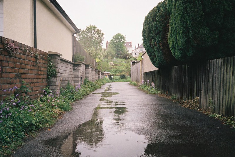
The line of the river runs up a gated alleyway, along the edge of the Birchall Road Allotments. We went up Cranbrook Road instead – laughing about how we’d never put two and two together than a road with “brook” in it must be close to a river! We explored alleyways, and looked at the line the river takes, curving from the allotments, up Dugar Road and into the Redland Green Allotments.

We had to leave the line of the river again, as it runs through the allotments, but we came back to it on Redland Green. I’d been wondering how many of the springs I saw last time were seasonal, or rain-dependent, and it was clear that some definitely were, as while the top of the Cranbrook was dry, at the top, by the Allotment gates, the pipe coming out of the bank of the path was flowing with water, a stream-let that hadn’t been there last time I was there. Excuse the terrible phone photo…

We followed the desire line along the fence, as the rain really started chucking down. The makeshift “bridge” of branches put across another stream was covering a pool now, and all the spring growth was full of water.
Last time, I had film camera problems, as I ran out of film, and this time my (new) camera just refused to load – I think it may be an unlucky place for me, so the rest of the photos are bad mobile shots. I’ll have to pick a sunny day to go back again, and see if it’s me, or I can be third time lucky…

We slid around the muddy slope, barely keeping out balance, and yes, the springs are definitely weather-dependent, as what last time was mostly muddy ooze now had a stream down the middle, coming from another pipe under the path at the top. This is a really poor picture, but I don’t know how I’d take it properly – just a stream-let coming out of the ground, which doesn’t look dramatic, but it still thrilled me.
It was ridiculously wet, so we decided to give up and get some coffee, but first we went back to that first spring, and what had been a stream to step across was now a spreading pool – I couldn’t believe how fast it had changed. I video’ed the rain on the water:
and recorded the sounds:
We walked back past the spring at the top of the slope, that now was a mini torrent too – here’s the sound of that:
The thing it really taught me was how quickly all the little rivers change with the rain. Of course I know the Avon changes a lot, and of course I can see from how deep the troughs the little rivers run through are, but it was different seeing it change so fast. We walked down the hills to Cheltenham Road watching all the gutters full of rushing rain water, a huge volume that the sewers and rivers carry out to the Avon. It makes me want to go out along the Malago, Coombe Brook, the Trym in the rain – although it’s a lot harder to photograph…
We were soaked through when we finally got to shelter, and had coffee, steaming slightly, then coffee-crawled down to Stokes Croft, looking at our pictures, and being amazed all our tech hadn’t drowned. I’m still remembering those conversations, and that’s what I love about these kinds of walks with friends – getting to explore the city, talking about so many different things, laughing as we nearly fell over in the mud, and sharing an everyday-adventure.
