August Dundry walk: Malago source, Maes Knoll and Hengrove Brook

Back in August, Vik and I took the bus to Hartcliffe, and walked over the top of Dundry, via the source of Pigeonhouse Stream, down the other side of the ridge, then up over the Maes Knoll iron age fort, and down into Bristol via Hengrove Brook.

It was a weird weather day, the end of the heatwave, and the source of the Stream was a tiny trickle, with the walls around it pulled down.  The fields everywhere were golden with stubble and scorched yellow by all the sun, and all day the clouds were grey above us, until it finally started raining.

Here’s a map of our walk:

And my album of photos – mouse/swipe over to start the slideshow, or click through to the album on flickr.

Chew Valley Lake, from Maes Knoll

Some things we saw…

Continue reading “August Dundry walk: Malago source, Maes Knoll and Hengrove Brook”

Some of my summer obsessions: fish, water lillies, jetties and rope

This summer I had some particular obsessions walking around the Floating Harbour.

Harbour fish

Photos in a slideshow, or in a flickr album and some little films

Watching the fish

Continue reading “Some of my summer obsessions: fish, water lillies, jetties and rope”

Pill to Sea Mills – with an added grass fire

One of the walks I’ve repeated is from Pill, over the Avon via the M5 road bridge and down the river to Sea Mills.  I first walked this with Tracy Homer in August last year, and then again in November, but I really wanted Vik to see it too, because there is just so much to see.  It takes in some really interesting spaces, especially the industrial ones, and it’s seeped in history – but this time it got very dramatic, as we got to see one of the impacts of the heatwave from closer than I even thought I would.

Here’s the map of our walk, from 5th August 2018:

An album of (a lot of) my photos – mouse/swipe over the first one to start the slideshow, or click through to the album

Fighting the Sea Mills grass fire

…and here are Vik’s gorgeous photos from her holga and deliberate double exposures from her Fuji PET – hopefully you can start the slideshow below, or click through for her album.

Folly

I’ve got some specific photos, some soundscapes and a mini film below, with thoughts on some of the things we saw, if you want more…

Continue reading “Pill to Sea Mills – with an added grass fire”

Storm damage to the Castle Park fig tree

Tonight I’m sitting on my sofa listening to the wind howl and rain strafe my window, and it’s making me remember the storm on 31st July, and what it did to the Castle Park fig tree.

There are a number of fig trees along the Avon, the Floating Harbour and even along the River Malago as they run through the middle of Bristol, brought into the city through trade from the Mediterranean, and they’re all thought to be seeded by accident, whether from fruit dropped off boats, or seeds brought in as ballast that floated down the river, catching hold in cracks in the harbour walls.

There are at least two fig trees in Castle Park, and the huge one, opposite the old brewery, is one of my very favourite trees in the city.  It’s thought to be the oldest of the figs, maybe helped to grow from the hot water that was let out of the brewery into the Harbour.  It’s visible in historic photos going right back to the beginning of the twentieth century, over 100 years ago – here are a couple of photos from Know Your Place, showing the fig trees in the walls in 1905, in the  1920s and in 1930 – and a very different image, after the neighbourhood that used to stand in the Park that was destroyed in the World War II bombing, and left the site devastated in 1951.

I love it in every season, and it’s something I look at every time I walk through the park.  I’ll always try to pinch the leaves between my fingers to get that gorgeous aroma.  Figs take two years to ripen, and it’s not yet warm enough for these ones to last through the winter to get fully ripe (yet), but I’ve used the leaves to infuse in custard to make deliciously figgy ice cream.

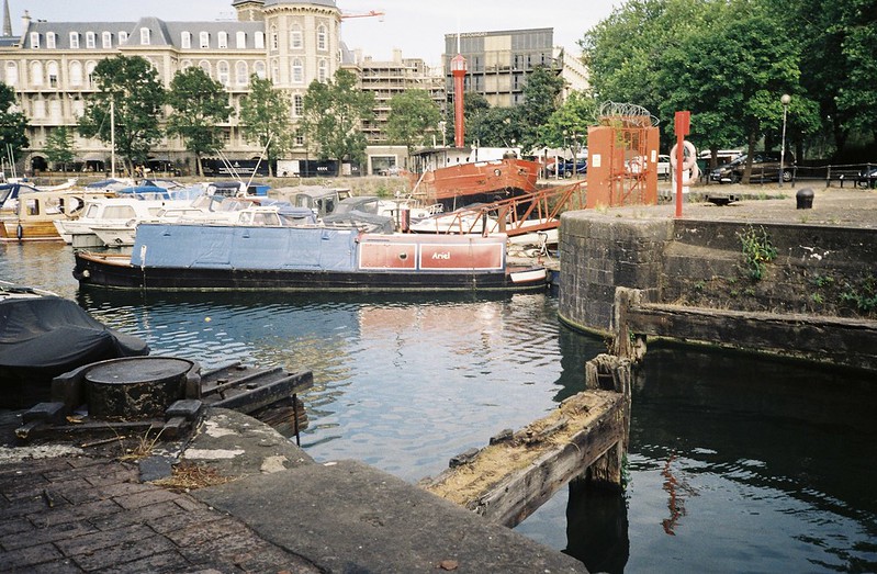
So when I heard that half of it had been pulled out of the wall by that July storm, I was devastated.  On 2nd August, Vik and I went to see what had become of it.  I took some photos of what we saw – mouse/swipe over the first picture for a slideshow, or click through to the album.

Harbour Master, fig tree

For a comparison, check out the size of what it looked like back in April, before the leaves came out:

Continue reading “Storm damage to the Castle Park fig tree”

Walking Brislington Brook

I’ve been thinking about walking Brislington Brook for a really long time, and looking at it on maps, planning and imagining, so I was really happy that on the last day of July, Tracy Homer, Vik and I got the bus out to Whitchurch to walk the full length of it, starting on the lower slopes of the Dundry ridge, all the way to the Avon at St Anne’s.  I was especially glad to go through some neighbourhoods I’ve never been to before, or only passed through in a car or on a bus.

Here’s the map of our walk

And my flickr album.  As always, if you mouse/swipe over, it should start a slideshow, or you can click through.

Brislington Brook in Whitchurch

There are a lot of photos in that album, and hopefully they fit with the map pretty easily, but I want to talk about a couple of the places, with some sounds, below….

Continue reading “Walking Brislington Brook”

A walk around some functional Avon spaces

At the end of July Matt, Vik and I were looking for a walk to do away from people, which was a bit complicated, with the Chocolate Path closed, and crowds filling Bedminster and Southville for Upfest.  It can be challenging, finding walks that start in the city centre and includes places we haven’t been, but the ferry trip down the New Cut and the Avon that Matt and I had taken had inspired me, and so we went to explore some of the places I’d seen from the boat – the functional spaces.

Here’s where we walked:

And here’s my flickr album from the walk – hopefully if you mouse/swipe over the first photo, it will start a slideshow, but if not, you can also click through.

fullsizeoutput_27b9

So what did we see?

Continue reading “A walk around some functional Avon spaces”

How the heatwave changed the mud texture

You know I love the mud in the Avon, especially the silt banks that block the second entrance lock to the Floating Harbour at the Cumberland Basin.  I love the way the light catches on the ridges and textures – but something about the summer heat and maybe the lower river levels seem to have changed the consistency of the mud.  It looks more porridge-y, and like the meanders have flattened down.

I like it just as much, though.  A flickr album of photos from walking home on 19th July, with patches of seaweed on the oddly flattened mud:

Avon mud textures

Continue reading “How the heatwave changed the mud texture”

The old lock gates at Bathurst Basin

I try to walk home from work in different ways and see different things, and I’ve been especially interested in the former lock gates that used to lead from the Avon to Bathurst Basin, as the entrance from medium-sized boats into the Floating Harbour.

These were blocked up during the Second World War, because the Nazis were already bombing Bristol, trying to destroy the Harbour, and if the narrow divides were breached, it would cause huge flooding, as well as damage the boats that were carrying food into and around the UK from across the Atlantic.  I’m always surprised that the gates were just left – I understand it in the War, but after?

The former lock from the Avon into Bathurst Basin

The former lock from the Avon into Bathurst Basin

The former lock from the Avon into Bathurst Basin

Find out more about the different entrances between the Harbour and the Avon in this podcast with Ray Gallop of the Friends of the Avon New Cut, last year.

A heatwave walk looking for streams on Dundry, and following the Malago home

Back on 7th July, Vik and I went looking for streams on Dundry.  Our plan was to find as many of the streams that join together and form the Malago, and then follow the river right down to where it joins the Avon… but things didn’t turn out that way.  To be fair, it wasn’t all our fault – and we still had a lovely day and saw lots of new things, even if we didn’t see as many streams as I wanted.

Map of our walk here:

My flickr photo album (mouse/hover over the first image below for a slideshow, or click through)

Gate

And some gorgeous photos Vik took, in her flickr album.

CNV00011

I also have sounds, words and photos below…

Continue reading “A heatwave walk looking for streams on Dundry, and following the Malago home”

Bristol ferry trip down the New Cut

This summer, I experienced something that was legitimately one of the very best things I’ve done in Bristol, and something I’ve longed to do for years – I went on the Bristol Ferry trip down the New Cut, to Netham Weir.

This is a rare trip anyway, as the Bristol Ferry Boat Company only run a couple of these a year, but for the last year they haven’t run them at all, as Ashton Avenue Bridge was covered in scaffolding for the Metrobus works.  In the past I’ve only seen these trips after they happened, but for the 6th July expedition,  I booked my tickets early, and persuaded some friends to come too – my good friend Matt Gibson, Charlie Revelle-Smith of Weird Bristol fame, and landscape architect Wendy Tippett, who I podcasted with last year about the Sylvia Crowe landscapes of the Cumberland Basin, and her architect husband Andrew.

Here’s the map of our trip:

and my album of photos – click through, or mouse/swipe over the first photo below, and hopefully you’ll see a slideshow.  I took a lot of photos, so I’ve written about them as well below…

fullsizeoutput_25c0

If you want to know about the New Cut, before I start, check out my podcast interview with Roy Gallop of the Friends of the Avon New Cut, who told me about the history of this very special part of the Avon.

Continue reading “Bristol ferry trip down the New Cut”