Back in August, Vik and I took the bus to Hartcliffe, and walked over the top of Dundry, via the source of Pigeonhouse Stream, down the other side of the ridge, then up over the Maes Knoll iron age fort, and down into Bristol via Hengrove Brook.
It was a weird weather day, the end of the heatwave, and the source of the Stream was a tiny trickle, with the walls around it pulled down. The fields everywhere were golden with stubble and scorched yellow by all the sun, and all day the clouds were grey above us, until it finally started raining.
Here’s a map of our walk:
And my album of photos – mouse/swipe over to start the slideshow, or click through to the album on flickr.

Some things we saw…
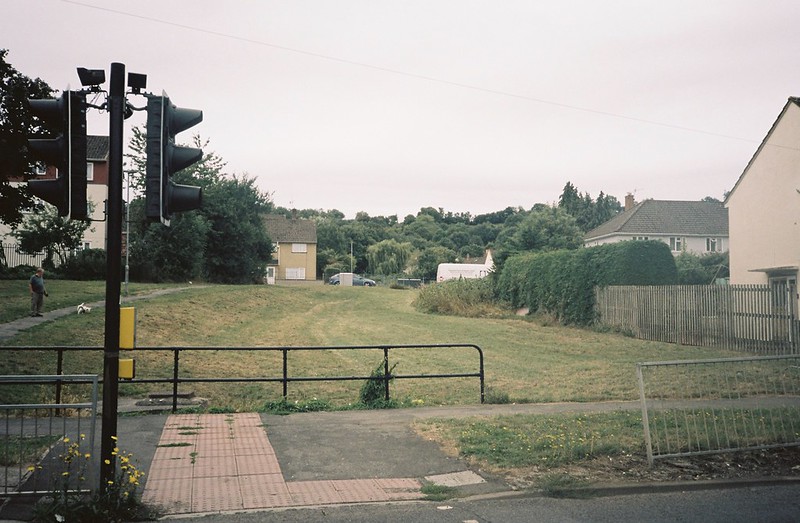
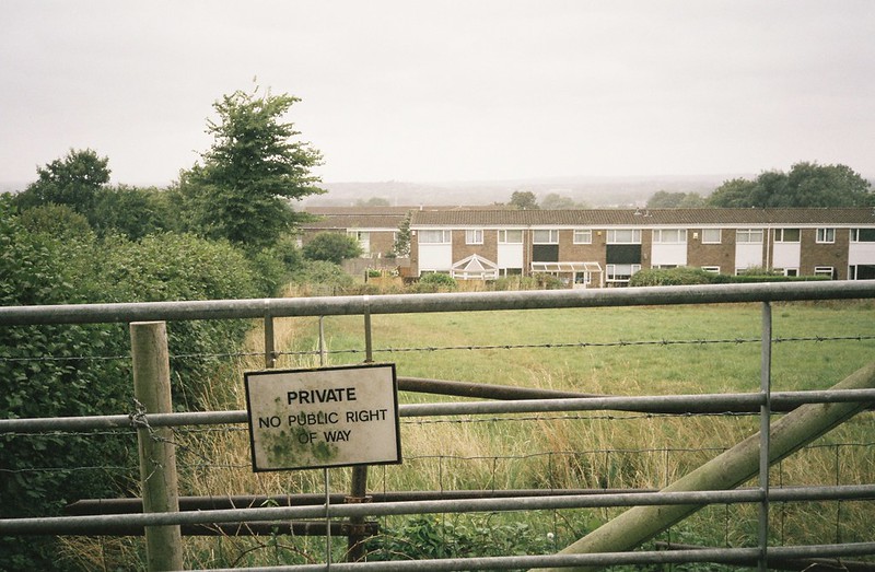
I really loved looking for the clues of where the rivers run through Bristol – this is the path of some of the culverted streams under Hartcliffe:

The Dundry ridge is usually teeming with streams and springs, and very muddy, but what few streams we saw were shadows of their usual selves.

The source of Pigeonhouse stream – dried up, and ripped apart. It was really sad on so many levels, especially comparing to when I was here in February with Tracy.
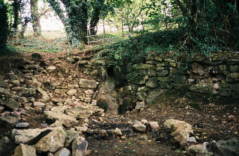


The sound of the stream was trickling…
…rather than the rush it was back in February:
Chew Valley lake from the top of Dundry ridge – this is one of the reservoirs that provides Bristol with water. The bright yellow field in the foreground was freshly harvested, but everything should be so much greener at this time of year.

The colours of the walk were greys and yellows. This is Maes Knoll iron age fort, looking at it from the south. The tump (defensive mound and ditch) on the left, and the ramparts on the right
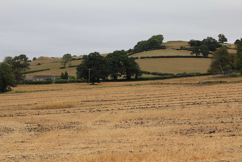
Drought landscapes


We could see so many buzzards wheeling overhead, and hear their cries, and the shapes of the land, looking west along the Dundry ridge was fascinating – I really wish I’d done landscape archeology at university…


I’ve never yet managed to get a good photo of the tump, but I really love it.

Looking east from the edge of the fort along the start of the Wansdyke – the earthwork-and-ditch defensive barrier between Celtic kingdoms. I really want to walk what’s left of it.

The tump again.

Clouds gathering
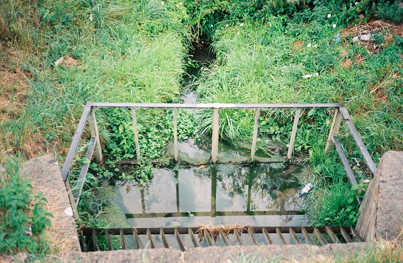
After we’d walked the full boundary of Maes Knoll, we headed back down, looking for Hengrove Brook. Again, it was dried up – here’s where it should start, with baked mud to show where would be a seeping well.


We followed the dry brook bed down through Whitchurch, as it started trying to rain – lots of water in the air, but no raindrops yet.

The line of the brook was marked by the long dried grass, where the lawnmowers has stopped at the edge of the ditch, and the wildflowers in the ditch, taking advantage of the shade and the remaining damp earth.


We got to a point where the brook should widen out, and this part was filled with the bright, vivid green prehistoric-looking horsetail, an invasive species. It was very grey, and my camera wasn’t liking it, but it was so green in the gloom.

I loved the little bridge.

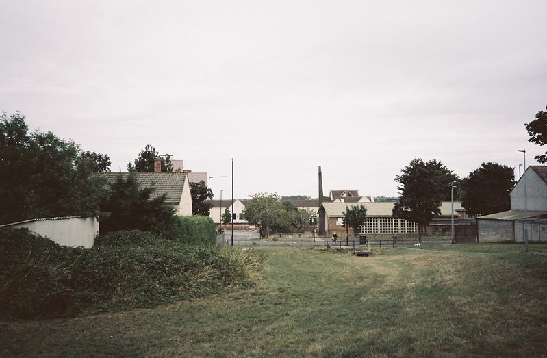
Where rivers run: it’s culverted, and there aren’t many clues, but I always like the manhole covers that give rivers away, especially standing over them to hear the water underneath – not much here, though.

After a very short road section, we were walking down grass again, between the walls of gardens, with a huge bank of blackberries hiding where the brook should run. We ate a lot of berries, wet with drizzle. The horsetail was all along the edges of the gardens here, too.

At the end of this stretch, the river disappeared under Whitchurch Lane – and this was the first time we could see running water in the stream bed – just as it was culverted again.
Where rivers run – the willows marking the stream, and the little bridge, marking where the river goes under Whitchurch Lane.

And to the south, the line of the stream runs under this alleyway, into Hengrove. I’m definitely going to walk this stream one day, but it was getting unpleasant, and too gloomy for photos, so we headed west to get a bus back home.

I liked the contrasts of the woodland, the open fields, the footpaths and the sub/urban sections. Walking through a holloway and in the valley, and being on top of the hill, where people lived thousands of years ago. I really loved exploring a new stream, and seeing Maes Knoll in a different mood. I was so sad about the vandalism of the Pigeonhouse Stream source, and about how the drought has changed the environments. All the nature that would rely on the streams and water, struggling this year.
And I’m still thinking about things we saw – how I shouldn’t like the horsetail, about the clues that show where rivers run, and the places there’s nothing to show there’s water around. I want to walk that again and again.
