One of the things I want to do with this project is to use it as an excuse to go walking, and exploring places I’ve always thought about – and last week was an adventure I wouldn’t have had without it.
I’ve known Tracy Homer for nearly 12 years, when we met at the first Bristol flickrmeet. Back when flickr was this amazing social media site, we were part of the Bristol flickr group, and there was this moment when some of us went to a pub to take it from online friends to In Real Life, which branched off into going for flickrwalks to take photos together. Some of my best friends in Bristol are people I met that way, and I still go to a pub once a month or so with some of them, even though we now arrange through different ways, and flickr has gone from being about social media to being somewhere I just upload my photos to.
I liked Tracy from the moment I met her, and I’ve got so many good memories of talking mile-a-minute with her, taking photos, discovering new places, and always laughing a lot. It’s one of those friendships where we can go years at a time without being in touch, but start where we left off, and she’s the best company for photowalks. There’s something about not needing to explain why the walk will take twice as long as it should, because we’re stopping for photos, with someone who’ll get exactly what I mean when I’m over-excited about the light on the mud, or the way the grass curves, or whatever it is, and will understand the need to take the same shot on three different cameras, because she’s doing exactly the same thing.
Last week we went for a long walk, one I’ve been wanting to do for ages: from Pill, up the Avon to the M5 road bridge, then down the north side of the river to Sea Mills, to look for echoes of the Roman town of Abona, and then up the old Roman road to the Downs. All walks with Tracy tend to start with frantic texting and laughing at ourselves right from the start, and this was no different. Could we manage to meet on the same bus from different stops? Of course we could!
This is the map of our route, with my photos on it, and there are more in my flickr album. I had four cameras with me – my Canon DSLR with a 50mm lens, my Olympus XA2 point & shoot film camera (though I ran out of film, stupidly), my iPhone, and the last of the £1 disposable underwater cameras, and there are some from each on the map, plus a mini film.
I’ve also put photos in the blog below. It’s a long one, because it was a long walk (that’s my excuse, at least!)
I really enjoy route planning, and like a lot of people, have been fascinated with maps since I was a child. I love unfolding my (out-of-date) OS Map, and imagining where I could go, cross-referencing with Google Maps, especially having a look for possible footpaths that aren’t on the OS map on the satellite view, and then comparing them both with my A-Z and any other maps I can find. I’ve been using GPX Editor, which Nikki Pugh introduced me to, where I can click between different mapping systems to see the same spot. I tend not to use StreetView, except to try to solve problems (what is it like under a bridge, for example, which is impossible to see from the other maps; can I see where an informal path I think might be there starts or finishes, and so on).
The pre-planning is part of my enjoyment of this kind of walk, so I had a definite idea of where I wanted to go, but with all kinds of room for adventure, and of course, exit points if we wanted to stop. It was all new paths to walk, and that feeling is so precious in a city I’ve lived in for so long.
We got off the bus in Pill, and headed to the Harbour. Low tide, so the boats were resting on the mud, with some fantastic structures to board them.
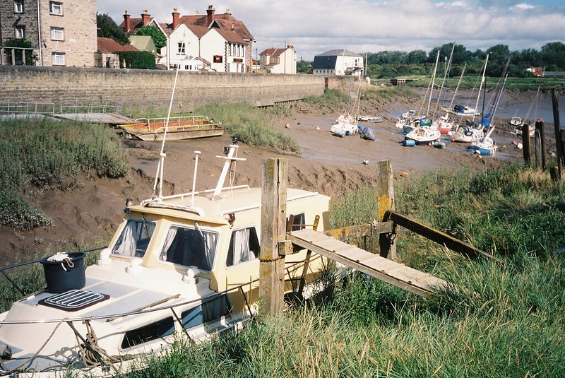
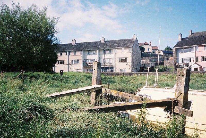
(I always struggle, choosing photos to illustrate something like this, because I can’t divorce the image from how I felt about it – from the delighted laughter about how everything looked, and how every new angle made things completely different, to things I look at and am reminded of what we were talking about at that point. I’d seen Pill, and many of the places we walked today, from the Bristol Ferry boat trips I’ve taken up the Avon, and being here in person felt so exciting. Clambering on the metal platform, trying not to get stuck in the sinking mud, feeling the breeze off the river on my face – and looking across the water knowing we’d be seeing the same places from the other side – I see all of this in my photos, so I can’t judge the images. And there are the photos that didn’t work, too, of the abandoned boat full of grass and weeds, and things I couldn’t capture, like the chains in the mud, and the angles of the mud and how the river looked too. And things that are impossible to photograph, like the sounds of the clanking of masts in the wind, things I felt, and the way the wind was sending cloud-shadows speeding across the river.)

We headed up Marine Drive, and then on the footpath along the river bank, walking towards the Motorway bridge, with the roar of traffic above us, and the industrial Port buildings beyond it, while behind us the Avon curved, perfectly rural. The official paths turned away from the water, but we carried on up the Pill Foreshore, all tough water meadow, with prickly sun-dried grass, on rough pasture-land that would suddenly drop into what must be a water-way in wet weather. It’s always so fascinating, wondering how a landscape changes, from dry in the hot August sunshine to presumably treacherous bogs, and underwater when the tide and rain combine.

The further we went, the harder it became, and the larger the ditches and muddy crevasses were to jump, so we changed direction, walking along the hedge full of dusty purple sloes that bordered the land, until we reached the shadows under the bridge, and everything changed.
We’d been looking at the boats on the other side of the river, and the plants, and the footpaths, in the heat of the day, and now we were in the cool shadows, gravel crunching underfoot, the roar of the motorway transformed into an echoing, almost-music, and the world around us industrial. Now that the bridge was out of the view, it was surprising me to see how close the hills of Wales were, and how the River Severn, the Bristol Channel, couldn’t be seen.

I always have a thing for being under bridges, in un-designed spaces. I love the graffiti that blossoms from the concrete, and finding places that are passed over millions of times a day, unseen, never thought of.

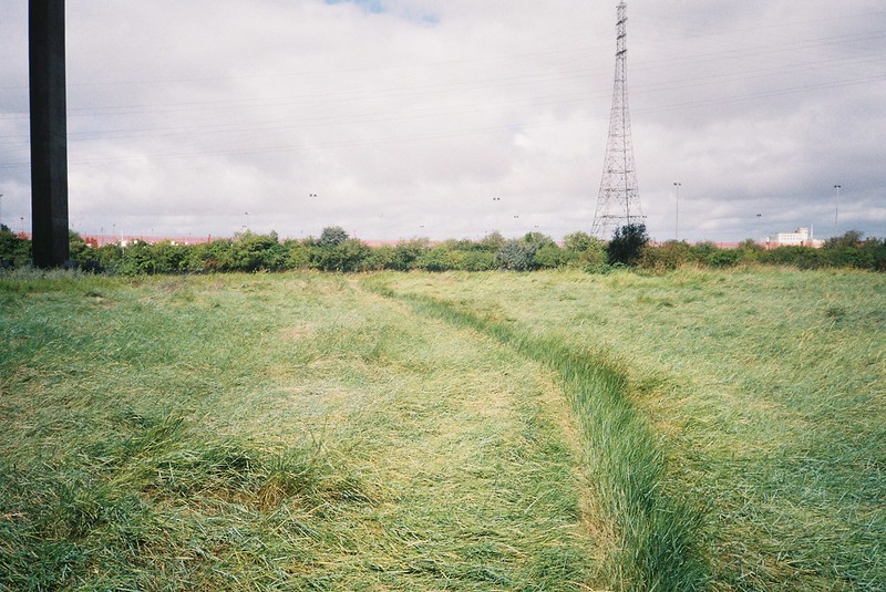
We were off-piste, so we had a little bit of an adventure getting onto the bike path over the motorway, and the choice of a field full of nettles, or scrambling down and up an empty concrete waterway and seeing where the road above it lead to – a locked gate, as it turned out, but a gap in the bushes at the top of the bank showed us that we weren’t the first to do this, and we could push through to the official path. And then we were on the path alongside the motorway.
I don’t drive, and living where I do in Bristol means when I’m occasionally driven on the motorway, we’d join it above or below the bridge, so I’ve been across it maybe three times. But I’ve seen it from a boat, and of course on the maps, and now I was walking it.

There’s something about walking in a place like this, that’s all about the car. The huge noise, for one thing, but the way the whole bridge shakes as everything passes at speed. On the side by the cars, it’s firmer, while by the fence on the River side, everything rattles and moves, the metal bars vibrating and trembling. It’s a strange feeling, and with the wind stronger, combined with the rush of the motorway and the tang of pollution in the air, it felt a little bit unsafe to me – but exhilarating. The dents in the metal fence protecting us from the road told a story, and I was convinced I’d drop my cameras over the edge, or somehow fall myself. We had to raise our voices to hear each other, and it was all “Look at THAT!” and not being able to take 5 steps without having to stop to see things from a different angle.

I’m especially fascinated with getting to see places I’ve walked from different angles – looking back, or down to the paths we’d taken to get here, and ahead to the ones we were going to take, is a bit intoxicating to me. Seeing the things we couldn’t see from the ground – what’s behind the hedge, the line of the railway, the ponds we never knew were there. And of course the river, seeing the lines of the mud from above, going from silver to brown depending on the angle, and how the water changes with every step, the wind blowing silver ripples across it, clouds casting shadows, the constant movement. And seeing it all with this feeling of mild peril from the rocking of the bridge, the occasional wave of vertigo, and with a good friend to show me what she was seeing, and to point things out to, all of that made it special too.


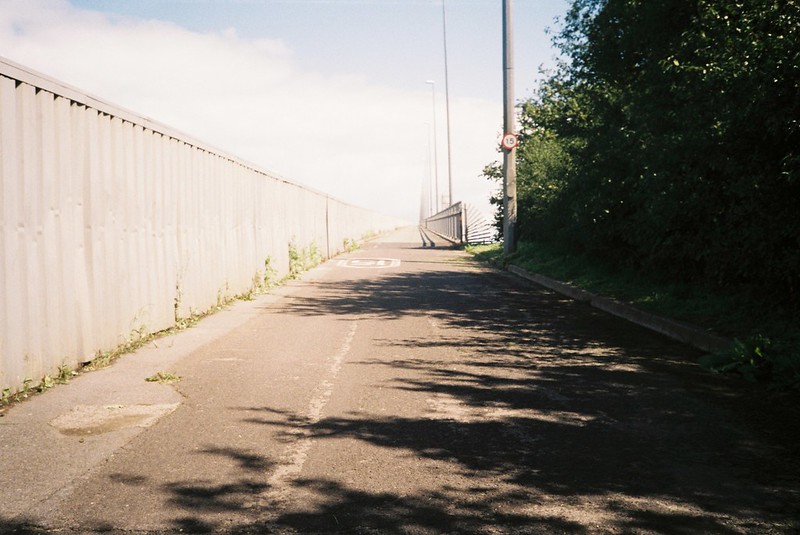
It’s a long walk over the bridge, the wide span back to where it can reach land, with all the space underneath for possible flooding. We tried to guess what the ports looked like on the other side, passed a few cyclists battling the headwind, had the fascinating feeling of watching people blackberrying from above, and looking down into gardens, and then we were by the stairs, and off it. The sounds changed again, and we were out of the sun once more, walking the non-space to cross the roads, passing a chip van (I guess to serve docks workers?), the Avonmouth homes where people must get used to the noise, the Trump-as-Captain-America graffiti that I admired but had no clue what it meant, then across the railway line and back onto footpaths again.

It’s a strange space, the path running from the start of the Docks, with the railway and Park & Ride on one side, bushes of buddleia and scrubland, a memorial to a young man in the undergrowth. And then you come out onto the marshland again, and it’s a new angle of the river. Paths we’d seen from the over side, and overhead, and now were walking. Things I’d thought were public art sculptures, but that turned out to be warning signs, information boards telling us we were in Lamplighter’s Marsh, and what that meant. Warning signs to boats, and metal picnic benches.

We walked a little way along the Marsh, rather than the path, following the tideline of flotsam and jetsam, everything from branches to twigs, deposited by the tide and bleached by the sun, cracking under our feet. It’s an intriguing line, making the contours of the ground visible, and made me wonder, was this the regular high water mark, or some extreme tide?
We ate our lunch on one of the green metal picnic tables, trying to read the words scratched into the paint, and talking about how the last year has changed us both, about art, about how we both have rolls and rolls of undeveloped film full of unseen pictures, for different reasons, from the years since we finished our photography degrees. The path took us away from the water, bushes on either sides, full of berries, blocking the views, making it feel rural, though the sounds of the motorway and the unnecessarily twisty path were urban. We couldn’t get to the boats we’d seen on the other side of the river, but we found the concrete structure, and looked across to Pill, now high tide, talking about photographers, feminism, and feeling a bit old.
We stopped at the Lamplighter’s Ferry, listening to the sounds of boat masts again, and wind in the grass, and the motorway, still, and I had this urge to try to walk down the slipway, and wade into the water. The sound of the river lapping at the edge of the concrete made me think of beaches, and the thought of cool water on this hot day was so tempting, even though my rational brain was warning me about slippery mud and sinking sands, and currents, and never getting out again.

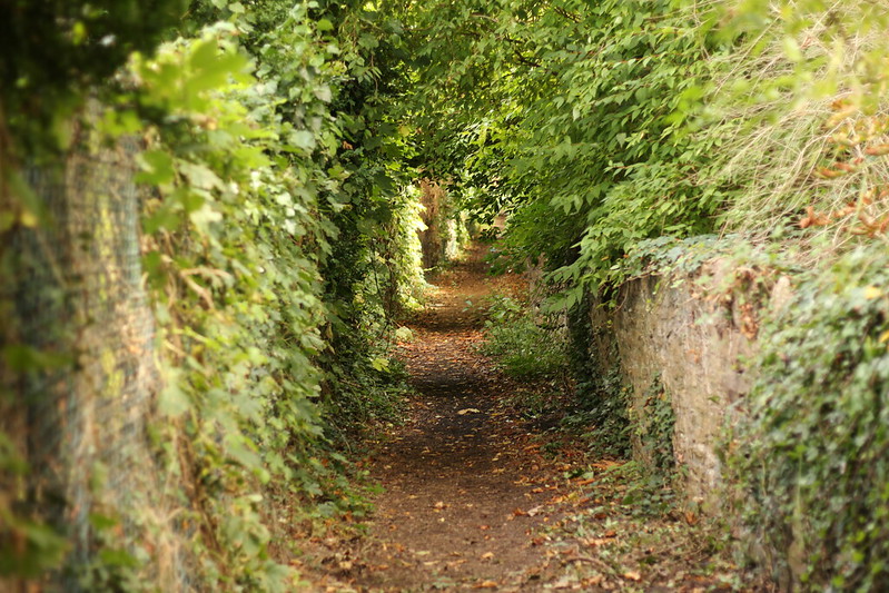
The next part was along the edge of playing fields and open spaces, via tree tunnels, and seeing the places I’ve seen from boats on the other side of the water: the white lighthouse, the steps to the former isolation hospital, where sailors were deposited to try to keep diseases from the city, the Chapel Pill inlet, with the mast of the wrecked boat just visible. Once we’d turned the corner of the river, it felt like the motorway was miles away, and the sounds were kids playing, wind in the bank of rushes in the curve of the river, and as we came off the path through another field, lawn-mowers keeping the open space tidy. Twisting through a 1980s suburban dream, and then onto footpaths again, along allotments and then taking us up into the woodland.

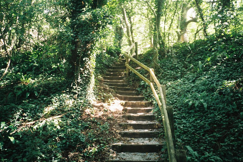
At this point, every time we got into the shade, we were grateful – I was sticky and prickly with the heat, and the woodland was a relief, even though it blocked the view. I say “woodland”, but it was a narrow strip, between the railway on our right and a major road, the Portway, on our left. Up and down flights of stairs, coming above the road, and then below it, the noise reminding us where it always was. We couldn’t see the river – so when we saw a gap in the fence on our right, where a tree had fallen, flattening the wires, we took it, and came out onto an unexpected viewpoint.
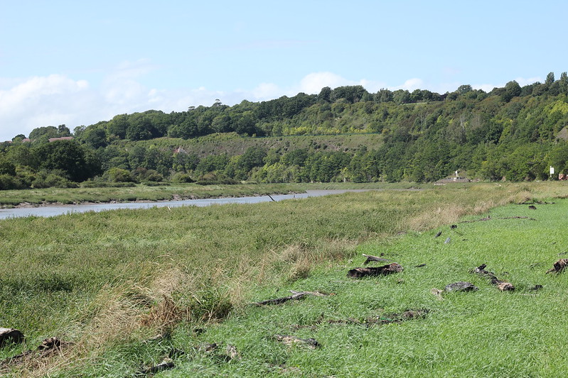
Horseshoe Bend is absolutely integral to the story of how Bristol stopped being a major port, and why we lost the shipping. A tight curve, it was always dangerous to navigate through, but as ships got bigger, it became almost impossible. If a ship got stuck, that was a problem enough, but then the tide would go out, the ship would most likely break up, and the whole passage would be blocked for weeks until it was cleared. I don’t know why the Victorians didn’t run a canal across the bottom of it, but I guess it was just easier to expand the ports at Portishead and Avonmouth. I’ve seen it from the river, and from the footpath on the other side, but this viewpoint was spectacular, and took my breath away.

The path continued on, changing heights with more steep steps, and there was something about this spot that grabbed me – all those different forms of transport, from the river, to the railway, to the oldest form, a footpath, and the road just out of shot to our left, but making itself known with the noise. And you can see the fence to block off the “viewpoint” – tall and sharp-topped, making us glad we’d gone off-piste. And then the comedy “viewpoint” on the Portway, with a rusty fence making the benches seem pointless, and back onto the footpath.

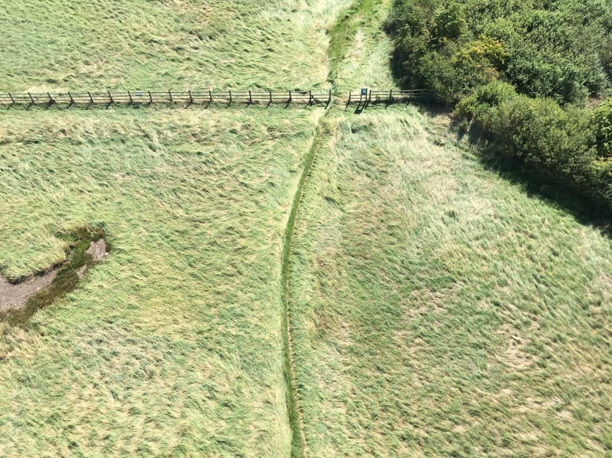
More tree-tunnels, more flights of steps in the wood, thigh-biting angles, then out into a meadow, with the desire-line bright green against the long summer grass, through a stand of ferns into woods again.

Despite the steps, taking us over ridges, we were gradually getting lower and lower, and we were alongside the railway again. I was eating blackberries as we passed, finally perfectly ripe, after all my summer walks watching them go from buds, to flowers, to hard green, to red, and now that luscious dark purple, warm from the sun. The taste still tart on my tongue as we turned a corner, under the shade of a railway bridge, with graffiti, the spikes of the fences painted different bright colours, breezeblocks pulled to make a circle around someone’s firepit, and the wind blowing off the river again. Birds calling, and distant traffic. My feet starting to ache, but happily.

Back on flood plains along the river, but the grass less coarse, with flowers in it, and the occasional reminder that this was a working river – and how much it has silted up since cargo ships stopped traveling down it.
And then we were on shorter grass, with a strange crunch underfoot – looking down and realising it had been recently burnt, a driftwood fire that must have got out of hand, catching the dried grass and tide flotsam. None of my pictures do it justice, the black earth with bright, vivid green re-growth contrasting against it. The feel of it under my feet, and the line where the fire must have stopped.

And coming into Sea Mills, knowing it was the last of these footpaths through the grass, back into the city after these hours of feeling like I was outside it.

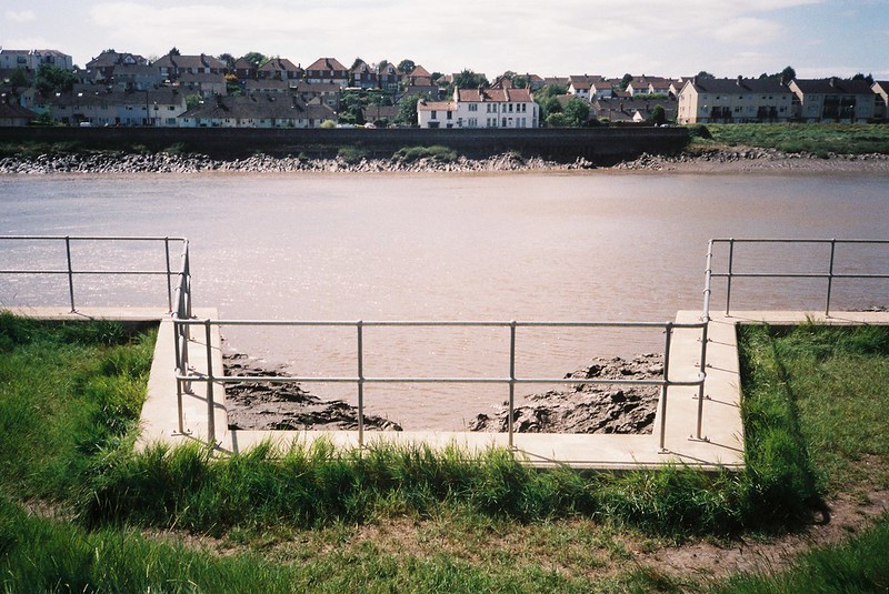
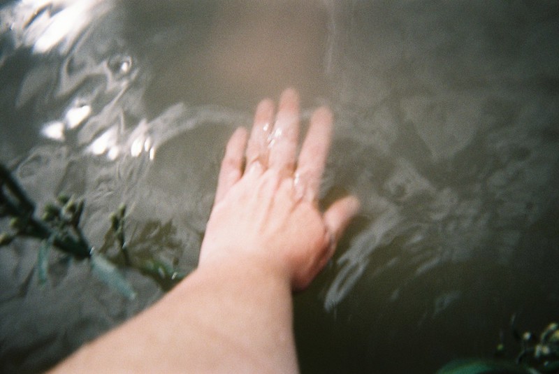
I had a mission in Sea Mills, to take photos of the Roman remains, and sites, that the podcast I’m putting up next will talk about. But the Harbour is fascinating anyway, and I stopped at the rickety metal steps down to the water, that I’ve stood on before, to take photos with my disposable underwater camera.

I won’t lie, I was a bit worried about it, especially the step from the catwalk down to the first step, half rusted through, but I’d left pretty much everything I owned with Tracy, so it was just myself to worry about if I fell in (the camera floats!).


I don’t think I’ve ever actually touched the Avon water before, so I was pretty excited. It’s murky, and full of silt, and you can hardly see anything in it, certainly not any hint of a bottom. I loved it.
While I was sat on the step, leaning forward to dip the camera in, pointing it at different angles, these huge boats passed us – the Balmoral, towed by a pilot boat, and some kind of dredger, a boat with a machine on the back. I guess it was high tide – and they slowed to take the Curve very carefully.

Next, it was Roman time. When I was in Sea Mills with Matt a few weeks ago, looking for Roman traces, I’d somehow missed the Roman ruins on the Portway, so we climbed the stairs up behind the station, and walked along this busy main road, under a plum tree, most likely grown from a stone tossed out of a window, and elderberries, bitter to the taste.

The Roman remains are so matter of fact, with the most suburban semi-detached houses on one side, and this arterial road rushing past on the other. There’s a fence on the long angle, facing the road, but on the other two sides it’s bushy hedges for some reason, so you can only see it from the front. They’re almost prosaic, but completely enthralling at the same time. Right here, this was a Roman street, almost two thousand years ago. I get so romantic about things like this, the teenager in me longs to touch the stones and see if I can feel some echo of the people who laid them, who may have brushed past them on a daily basis. These foundations say nothing, but they say everything, and it’s a reminder to me that there are these layers and layers of history under our feet everywhere we go.
If you want to know more about the Romans in Sea Mills, and Bristol in general, I have a podcast interview with Gail Boyle, the Senior Curator of Archeology for the Bristol Museums. I’ll be putting that up tomorrow, with a lot more links.

After the ruins, it was up through this stereotype of a middle class 1950s street, to look for the (alleged) track of the old Roman road. I’ve never been through this part of town, and we turned into a curving road, the gutter absolutely full of crabapples, with three very well spoken young boys on bikes arguing about which shop to go to. The air was full of the smell of apples, crushed below car wheels, and it felt like something out of Enid Blyton, and then we turned into very posh Bristol.

A thatched cottage, with a thatch fox and kangaroo on the roof, and giant houses with fancy cars – I was glad to turn off, onto this strange footpath running parallel with the road, a straight line up the hill, bounded by garden fences and walls. Beech trees and pine trees overhead, so the ground was soft with nutshells and pine needles. It felt amazing, this odd little world surrounded by incredibly expensive properties, coming out onto roads, changing depending on the garden boundaries.
We detoured into a churchyard we passed, as Tracy has a project on World War I graves, and were amazed by the ornate gravestones, with Celtic designs, and elaborate floral carvings – one in particular, red with lichen except for the carved undersides of the arms of the cross, showing white marble.

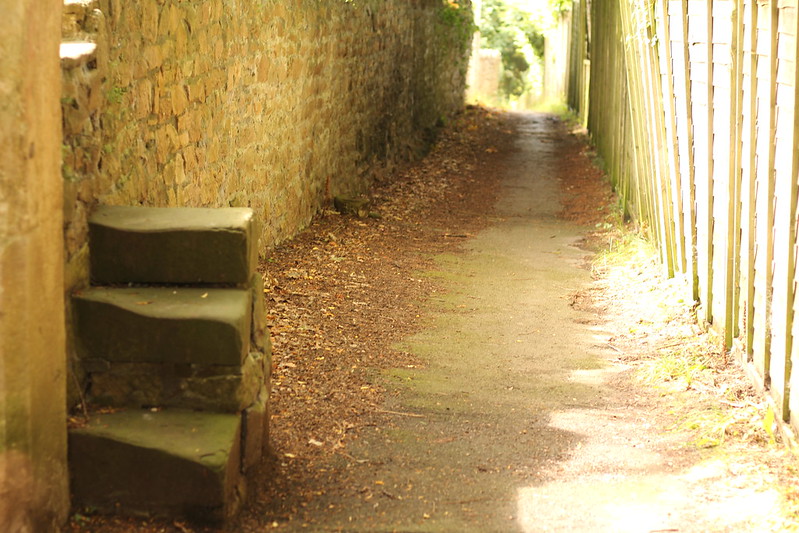
The edge of the graveyard was a wall, with a gate knocked through, and next to it, steps to climb over. It was all very genteel, and not at all Roman.
By this point we were very definitely ready for a café to appear, and to me, at least, it was more of a trudge, up, up, up, across a road, and then the path turned into Pitch and Pay Lane, and then Julian Road, and then the Downs. I always feel like I’m going to die at this point, when I know I’m 5 minutes away from a stop, but I also know it’s all psychological. We hit the Downs, grabbed cold drinks, and sat outside in the breeze, so pleased with ourselves, and full of everything we’d seen.
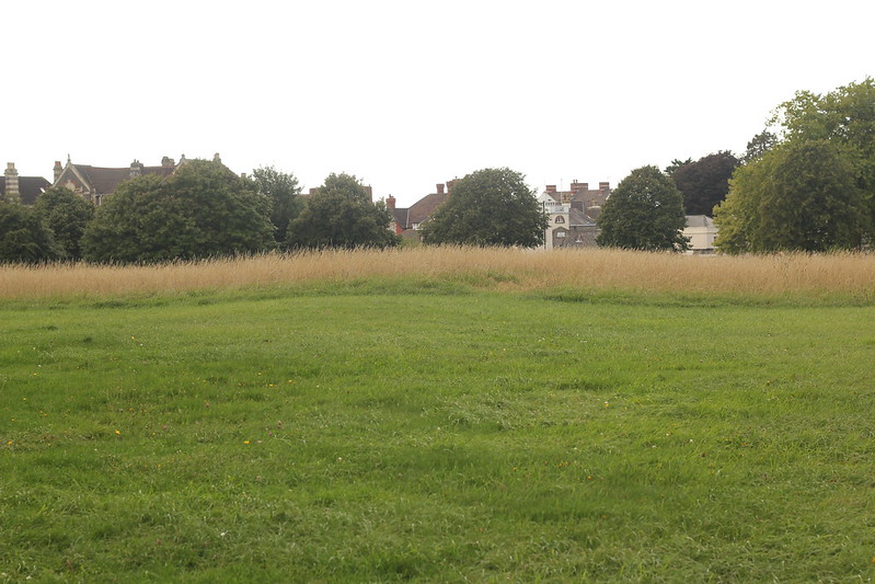
The actual Roman road on the Downs (which doesn’t follow the same line as the footpath, though it’s near enough) is a disappointment, but I knew it would be, as it’s only really visible in the early morning or late evening light, or on a frosty day. But we spotted the place it humps, and that’s enough for me! And I can come up here in the Autumn, when the grass will have died down, and all that Golden Hour light is at a civilised hour.
***
I loved that walk. I loved the company and conversation, I loved all the different aspects of the river we saw, and I loved the fact we explored so many new places. My brain has been full of it, ever since, and I can’t wait to go back and see those spots in different seasons: what the Pill Foreshore will look like on a bleak winter day, or on a spring day; Horseshoe Bend and all the tree tunnels in autumn, or with spindly winter bare branches, or with new growth in the spring. I’m already imagining different walks using parts of this one as a jumping-off point, and poring over my OS map, looking at the Avon and the tributaries. So many more places to discover!
***
My huge thanks to Tracy – you can check out some of her photos via her twitter. can’t wait for our next walk!

3 thoughts on “Exploring the Avon – Pill to Sea Mills, and following in Roman footsteps”