Back in July, I went to Portishead for the first time, where Dave Chillistone of the Portishead Railway Group took me on a podcast-walk around the town and told me about the history of the Portishead to Bristol railway line, and why it should be re-opened. One of the things Dave told me about was walking the line to Pill, and I promised myself I’d come back and walk it myself, before the railway was re-opened. It needs to be walked in the winter, when the summer plants had died back, and Monday turned out to be the perfect day to do it – sunny, cold and dry.
My photos are here (Olympus XA2 35mm point & shoot, Canon 550D DLSR and a couple of iPhone). If you mouse over or click on the first picture, it should take you to the slideshow, or you can go directly to the flickr album. And there are words and a map below too.

I walked with my friend Tracy Homer, as part of our sporadic programme of Avon walks – we’ve walked from Pill over the M5 and down the Avon in August and November 2017, and from Netham down the Greenway in October. I love walking with Tracy, for so many reasons, but especially the conversation, and getting to see things through her eyes, and spotting things I’d never have noticed. I always smile when she says she’s taking “a Sarah photo”, because there are very definitely things I see that are “Tracy photos” for me too. Getting to see a little bit of what someone else is seeing is such a privilege, and adds so much to my own photography. Plus there’s a real honour in someone trusting me to wayfind, even when they probably shouldn’t… but more on that later!
We started with the always-impressive feat of me catching the same bus Tracy was on, and got off at Sainsbury’s in Portishead, walking up to the Old Mill pub, which used to be the quayside and seashore before the land that’s now the Marina was reclaimed from the sea, and then headed up to Nore Road, a hill overlooking the Bristol Channel. We walked west for a while, to see the sea, along the high road, and then down on the footpath that skirts the edge above the beach.

I don’t really know how to describe this place. It’s not a cliff, it’s not high enough, so maybe a shelf down to the beach? But beach is the wrong word too, because the Bristol Channel is mostly silt and soft mud, as all the warning signs will tell you, with occasional areas of rocks and pebbles. It’s a really dangerous sea, with a tide that roars in at incredible speed and currents that would drag you down the coast in a heartbeat, but it’s also very beautiful. It’s not a romantic beauty, like the Gower, or the cliffs of North Yorkshire, and it’s edged with industrial structures, but it’s unique, and has so many different characters. Today it was low tide, with the curls of waterways down through the mud, and a clear blue day, the hills of Wales looking so close, and the water a continual movement of colours as cloud-shadows passed up the Channel.
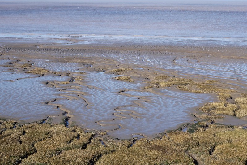


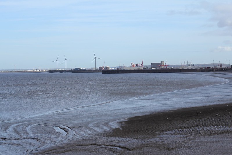
After so many grey winter days, it was fantastic to see more than tones of grey: green grass and rich brown bracken on the shelf; the darker green of algae on rocks that almost looked fluorescent in the sunshine; the browns of the winter grass on the silt; and of course all those blues. The wind was strong, keeping the sea in motion and freezing us if we stood too still. We walked down the coast, then turned back, going up to the headland, passing some fantastic signs, a small lighthouse, and around to the jetty, with views of the Bristol Ports, and the walls marking where the Avon leaves the Channel. After stopping for a coffee to avoid a squall of rain, we’d finished the warm-up, and were ready for the railway.
I had no idea what to expect, although I’d seen photos, because walks like this change so quickly. The railway is fenced off from Quays Avenue with a huge fence that I’d photographed in July, but there’s an opening at the side, and we wondered if it was seen as easier to let people in than have them find their own ways. The first part was a chicane of finding the gaps in fences from one side to the other – but inexplicably the fences stopped, and as a footpath crossed the rails, it was completely open leading down towards Bristol. It didn’t really make sense, after all the fences, but we weren’t complaining, and we were off.

The first part looked like it had been cleared recently, and was easy walking, whether taking long strides from sleeper to sleeper, or walking next to the rails. It passes through the modern development, but is such a nature-corridor, with birdsong on every side, all the way down.

This first section ended under the first bridge, where Sheepway crosses the line, and while we couldn’t see the sea on the left, but we could see the houses abruptly stop, the reeds of the nature reserve, pylons, and occasionally the brightly coloured cranes of the docks.
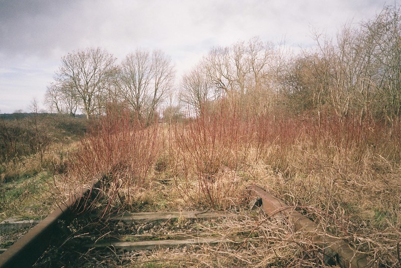
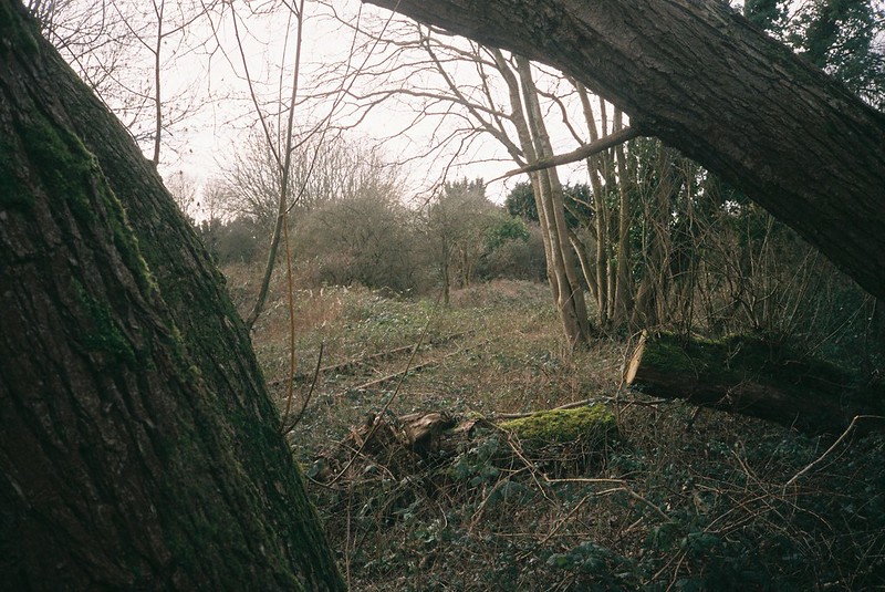
Crossing under the bridge changed the walk too, moving from what felt like recent clearing to maybe a year of growth, still easy to walk through, but now there were plants growing in the gaps in the sleepers, and different kinds of undergrowth. What interested me was the variety in different kinds of plants – a stand of teasels, and after we passed through an unlocked gate, a bright red line of dogwood running across the width of the line. The kinds of trees varied, from silver birches glowing white in the sun, to oak trees making a carpet of leaves under our feet. We could see where the branches that faced the lines had been chopped back, and I’m so glad I saw these trees, because undoubtedly they’ll all be cut down when the railway returns.
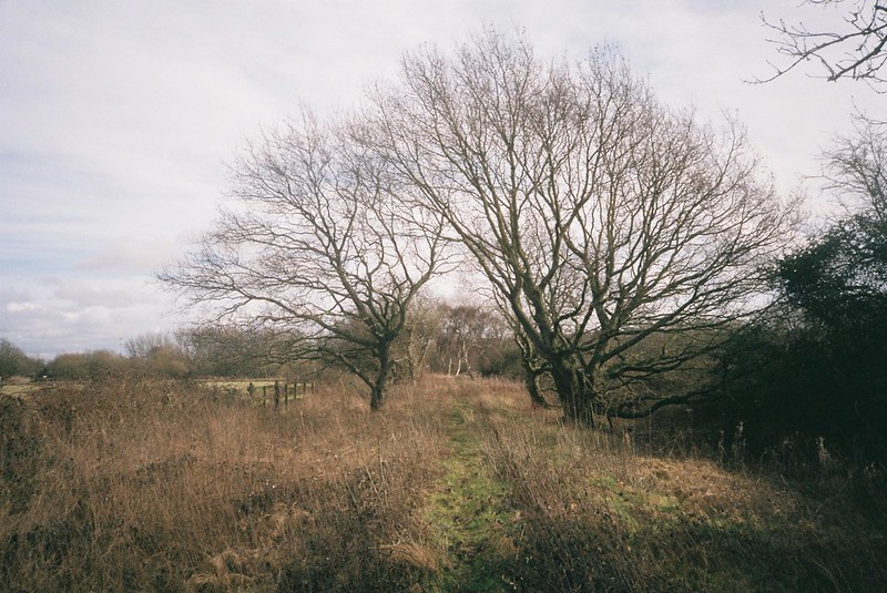

The sleepers changed too, getting grassed over, and becoming occasionally spongey when we stepped on them, and the path down the middle became narrower, or crossed the lines, taking us from one side to the other. We could hear the sounds of the motorway to our right, and the birdsong to our left. And then we crossed another border, where a farm track passed over the rails, and it was clearly another gap since this section was last cleared, and the brambles began.
They started pretty benign, just one year’s growth, but it changed our strides. Instead of those long steps, now our steps were taller, reaching our feet up to tread down the brambles to get through. They didn’t look so bad, not the impenetrable hedges you often see, but it was hard going, especially when we passed another boundary, where another farm track intersected with the rails and now they were knee high.

This was hard going, and if I’d known what was coming, I would have come off at that track, and taken the footpaths, but we pushed through. My shoelaces were pulled loose 100 times, and the thorns were older, so tougher and sharper, scratching my legs through my jeans. It was like walking through snares, having to take big giant steps to avoid the curves of the brambles snatching our feet from us. Getting to take two or three bramble-free steps felt like a luxury.
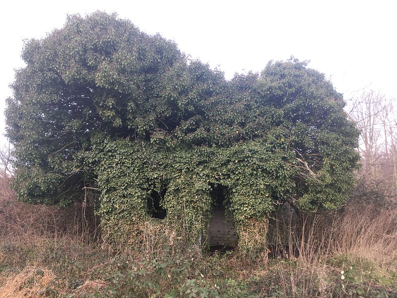
We could still stop and look at things, like the hedge of bamboo that had escaped to start colonising the rails, and the hut that looked like a koala’s head that I’d completely missed, but Tracy made me battle back to see (and hell yes, she was right! The only lens I had wide enough to fit it in was my phone, so it’s a bad photo, but that ivy!)
By this time we had to push on. We had a little relief after the second Sheepway bridge, but we were back to the brambles again in no time. Someone had walked before us, hacking through the stems, but this didn’t help much, and we were just looking down, pushing through one step at a time. We could see a spot on the map where we could hopefully get off the rails and onto the footpath, and we’d stopped for lunch before our final push. Climbing over a felled barbed-wire fence, down and up a ditch and along a rhyne, and we were out and onto the cycle path.
The path here runs between rhynes and the fenced-in Port land, with rows and rows of brand-new cars, no number plates, uncanny clones shining in the sun. Along the rhynes, pollarded willow growth shone in the sun, and the path twisted and turned along the edge of the Port land. Huge fences, and suddenly there’d be a gate into the Port inexplicably open, and on the other side, work being done putting down more car parks. A hedge of young trees bursting out of their rabbit-proof tubes, and the path joining and leaving the rails again. And the noise of the motorway louder and louder, until finally we passed underneath it, walking along the rails.

At this point we had a decision to make. Our original plan had been to walk back down the river, and we could have taken the footpath over the M5, and repeated at least some of our Pill walks, but that bramble section had been exhausting, and my phone showed a café in Pill, so the obvious choice was re-fuel before making decisions. Or it would have been, except the one café in Pill shuts at 2:30. We thought about walking on, but the sensible choice was a bus back to Bristol for that coffee, satisfied with what we did.
It was a really good walk, and despite all my scratches, I’m really glad we did it. If that railway line ever does get re-opened, I’ll be super-smug when I take the train journey up to Portishead, looking at all the things we saw on that walk. It feels really time-specific, and while I absolutely agree that the line should be used again, it was a special thing to be able to have this chance. Just, if you decide to do it yourself, take my advice, and come off on that final track, before the second bridge!
The map of our walk is here:
To find out more about why the railway line was opened in the first place, why it closed, and is coming back, listen to my podcast. Thanks, as always, to Tracy for being fantastic company, and laughing as I drag her into prickly situations – can’t wait for the next walk!


Loved the narrative; loved the stories! Many thanks.
LikeLike
Thank you!
LikeLiked by 1 person