At the end of July Matt, Vik and I were looking for a walk to do away from people, which was a bit complicated, with the Chocolate Path closed, and crowds filling Bedminster and Southville for Upfest. It can be challenging, finding walks that start in the city centre and includes places we haven’t been, but the ferry trip down the New Cut and the Avon that Matt and I had taken had inspired me, and so we went to explore some of the places I’d seen from the boat – the functional spaces.
Here’s where we walked:
And here’s my flickr album from the walk – hopefully if you mouse/swipe over the first photo, it will start a slideshow, but if not, you can also click through.
So what did we see?
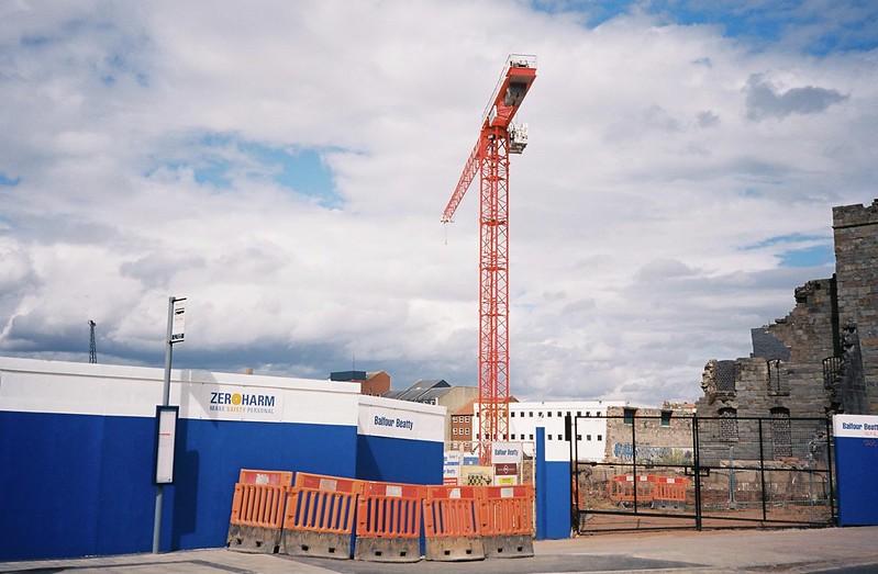
We started at the M Shed, and walked down Cumberland Road. I was in love with how the old gaol gatehouse was looking with the orange of the crane and the barriers and the blues of the sky and the fence, but there were so many cars and people going past, I couldn’t frame the ideal shot, and this is as near as I could get to the photo I wanted
We were heading for the new bridge over one of the blocked-up entrances to the Floating Harbour. These days, there are only two: Netham Lock in east Bristol, which leads from the Avon into the Feeder Canal, and the Entrance Lock into the Cumberland Basin on the western border of the city, which is the only connection between the tidal Avon and the Floating Harbour. But there used to be two more entrances, for canal and other inland boats, just to the east of Temple Meads station, and the entrance for medium-sized boats, at Bathurst Basin.
I’ve talked about this before, and my podcast with Roy Gallop of the Friends of the Avon New Cut (FrANC) has a lot more of the history about it, but the short version is that during the Second World War, the Nazis were bombing Bristol to try to destroy the Harbour, as it was a key resource and location for bringing food, supplies and troops across the Atlantic. Bombing the Harbour would also have impacted in other ways, as if the entrances were hit, it could have caused major flooding. So in a pre-emptive move, the two smaller entrances were blocked up, to reduce the number of targets.
I had taken photos of what remains of the old lock gates from the Bathurst Basin side a week or so before, but this time we were going to the river side.
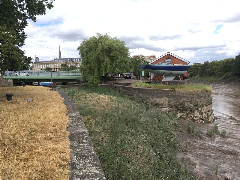
The Bathurst Basin entrance is still dramatic, with the curve of the wall on one side, and on the other, a narrow open space called God’s Garden between the Cumberland Road and the river. It was a cloudy day in the middle of a huge heatwave, and the contrast between the scorched grass and the green of the silt-bank, which gets “watered” twice a day by the tide, was enormous.
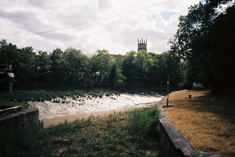
There aren’t any remains of gates on this side, but you can see where they’d been by the shapes of the wall, and bits of metal remains.


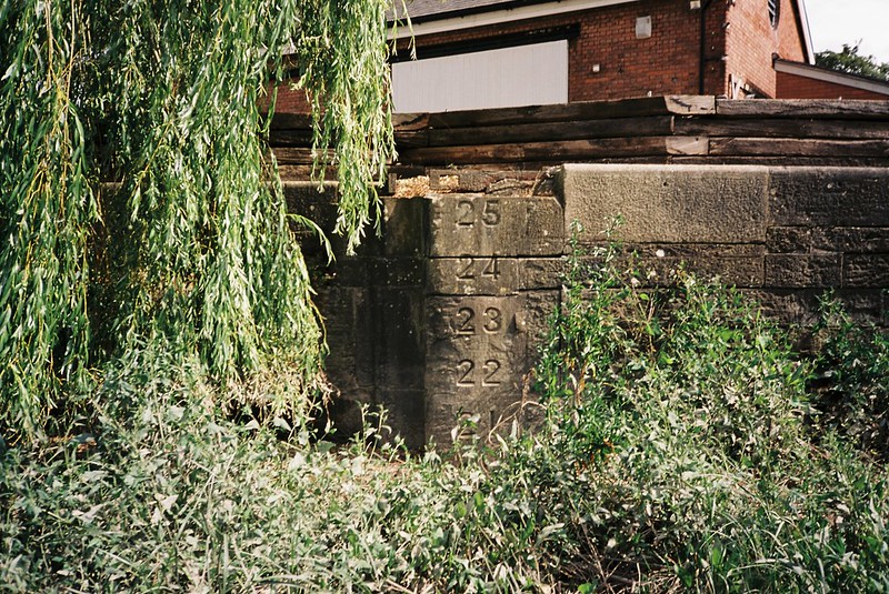
The tide was low, so I could get closer. I don’t know why I’ve never climbed down onto the silt bank before, but it was pretty thrilling to be standing where so many boats had passed in and out, and was such an important part of Bristol’s industrial history.

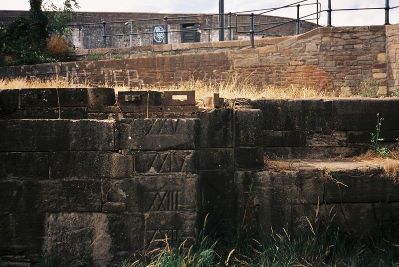
I especially liked the numbers carved into the stones, to show the height of the water that would have been here – but I’m a bit bemused why it was carved in Roman numerals as well as numbers

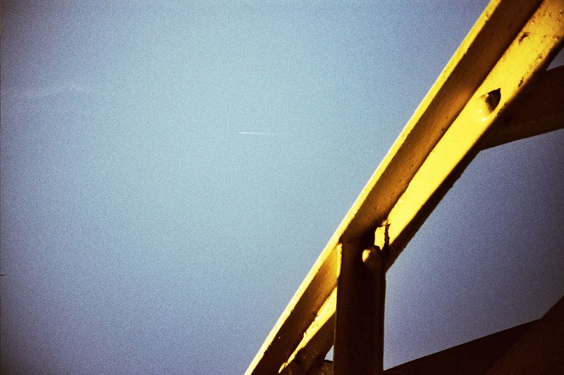
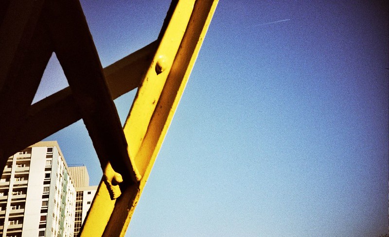
We’d come to have a look at the new bridge, which runs alongside the old swingbridge, with a new cycle and walk path. It’s a bit of a baffling bridge, because it is so incredibly ugly. It must have been designed, because everything is designed, so how on earth did it end up like this? My photos don’t do it justice, because in real life it’s so soul-less, with the infrastructure equivalent of charisn’tma (hat tip to Terry Pratchett).

It was good to get up close, and have a look over the wall into the Basin


We walked across the bridge, and carried on along the north side of the Avon, stopping for views of the river, and the undulating gabions trying to hold up the bank on the south side.

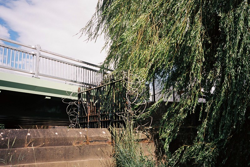
Our next stop was the Asda roundabout, which crosses the double span of Bedminster Bridge. This roundabout was on my commute route for most of the 8 years I worked in Temple Quay, and I cross it on every journey to the train station, and for all kinds of other reasons – but I’ve never even thought about walking on it, until I looked at it from the new angles of the ferry trip. It felt like maybe we’d have to run across the road, but of course the traffic lights make it really easy to get to. On the west bridge, there’s a pavement that must have been used once.

The things I noticed most about the space was the trees. I’ve always looked at them, but never noticed how low the willow on the north side hangs, for example.

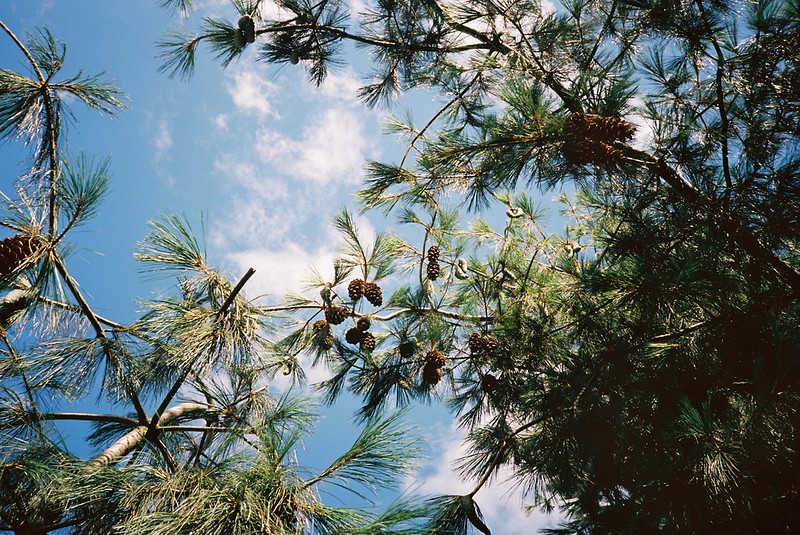
And on the south-east corner, there’s a huge, beautiful pine tree, with giant pine cones. It smelled incredible under there, and I picked some of the cones up for Matt, leaving my hands coated in sticky, scented pine resin for the rest of the walk.
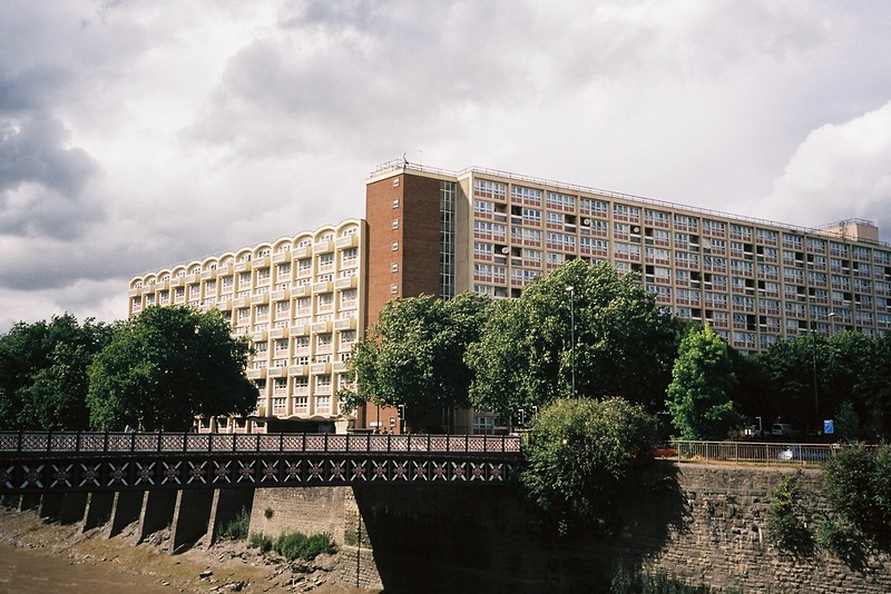
The other thing was seeing familiar patterns from different angles – like the side of the western bridge against the Redcliffe Dr Who flats.

We crossed on the south side, and headed east along York Road, with the river on our left. I don’t know who it is who feeds the birds, then leaves their bread bags tied to each side of the river, but it drives me crazy! Why do this? (the same person has been doing this for over 10 years, if not 15)

Our next stop was the set of steps just to the east of Bedminster Bridge. It’s definitely a functional space, to give access to one of the storm-water outflows, and the steps are somewhere I look out for whenever I pass on the other side.
We hopped the fence and went down them, and at the bottom, the peeling mud still had footprints I’d left in it at the end of June, when I stood here on my way back from a daytrip to Cheltenham (mine are the prints with wavy patterns)

The Avon silt does this a lot – it gets left by the river in a thick, gloopy coating that then separates and pulls away from itself into flakes, that if it gets hot, will curve up and the edges and peel away. I’m surprised my footprints lasted so long, but the summer spring tides are lower than the rest of the year, and with no rain to boost the water levels, this part hadn’t been covered since June. I always want to come here for one of the very highest tides, and see how many of the steps are underwater.
I like this spot for the views: looking west, across the river, and then east.


Looking back up the steps, and then down them again, from York Road:


It’s an arterial road, with lots of traffic, with long terraces on one side, of buildings from different times, and the wild riverbank undergrowth on the other. I am pleased with this shot:

We stopped by the wild fig, to rub the leaves between our fingers to release that gorgeous smell – so it was pine on one hand, and fig on the other, now.

Of course we stopped at the Banana Bridge, which might be my favourite of all the Bristol bridges. I have fond memories of this bridge, and learning to take film photos, and getting so excited by the colours and the shapes. I haven’t cross processed film for years and years (filters made that look ubiquitous, and I think the great colours distract from bad composition) but these pictures from 2005 are some of the ones that made me fall in love with film:
and who I was in 2007, playing with overpriced lomography cameras that typically broke after 5 films…


These days my style is much more low key!

The thing that was incredible that day was watching the sky change. It was still the middle of the heatwave, but all these thick grey clouds were massing over us. Matt’s digital camera shows it better than my film:

My Olympus XA2 shot at the same time:

But my film shot of just the clouds above us looks satisfyingly dramatic:

We stood on the bridge and watched the river fight itself, with the tide going out against the waves pushed by the wind in the opposite direction.
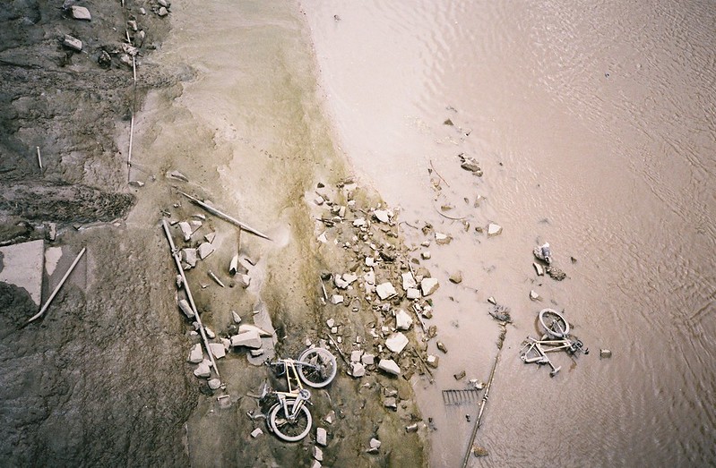
Looking down at things thrown from the bridge, and east to the direction we were heading

After the bridge, the buildings get more industrial and business like, and lower. We crossed the road, looking at the edge of Temple Meads as we crossed the river again next to it, but I couldn’t get photos with the XA2 lens.
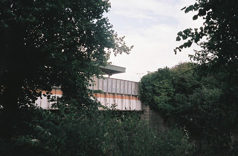
One of the things I really liked about the ferry trip, but couldn’t get a photo of, was the old-school Intercity logo painted on the Bristol Temple Meads platform across the river. I’m still not happy with this, but it’s close
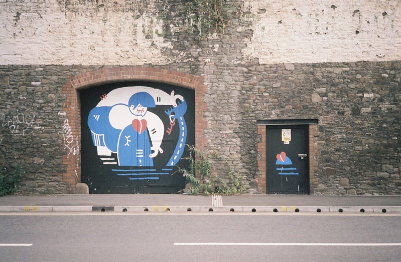
We walked past the final former entrance to the Harbour, but I was running out of film fast. We could hear the thump of music from the outdoor party at the Motion skatepark/club, as it reverberated in some really interesting ways off the buildings and the water. I loved the graffiti opposite the Feeder basin against the cloudy light.

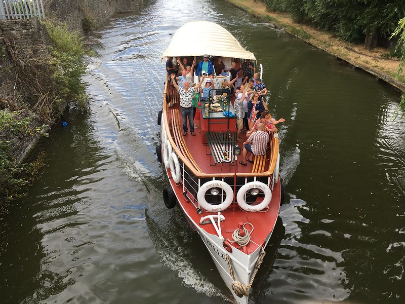
With the Motion music on one side, there was more coming down the Feeder, with what was very definitely a party boat…

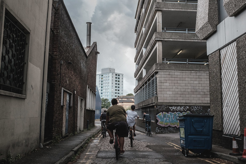
We walked through Temple Quay, empty as usual in the weekend. I was out of film, and almost out of phone battery. We went into the horrible Starbucks for coffee, as the clouds opened, so wonderful to see after the heatwave. It was only a cloudburst, and it was over as we walked back through the (endless) roadworks by the station, and down the little alley, where this happened – such a great photo from Matt!
We walked back along the north side of the river, and said goodbye to Matt on the roundabout. It was raining again as we walked through Bedminster, and even though I was in all the wrong clothes, it felt beautiful, after so long without it. A lovely way to end a superb walk.