I’ve been thinking about walking Brislington Brook for a really long time, and looking at it on maps, planning and imagining, so I was really happy that on the last day of July, Tracy Homer, Vik and I got the bus out to Whitchurch to walk the full length of it, starting on the lower slopes of the Dundry ridge, all the way to the Avon at St Anne’s. I was especially glad to go through some neighbourhoods I’ve never been to before, or only passed through in a car or on a bus.
Here’s the map of our walk
And my flickr album. As always, if you mouse/swipe over, it should start a slideshow, or you can click through.
There are a lot of photos in that album, and hopefully they fit with the map pretty easily, but I want to talk about a couple of the places, with some sounds, below….
We started off with a bit of a bus disaster, and walked up a cycle path from our bus stop, eating blackberries as we went. We could have gone a different way, and started higher up on Dundry, but there was a well on the map outside Whitchurch, so we walked up over some some the streams that become the Brook to see it. I’ve said it a lot about the walks this year, but the dry 2018 meant that some of these were dry beds, and I was disappointed that the well was dry too.


One of the things I’ve learnt this year is that a “spring” can be a marshy area where water oozes out of the ground, rather than a gush of crystal clear water from a cleft in the rocks, and I’ve learned that about wells too – that the well sign on maps are as likely to be seeps or pools as they are traditional bricked-in deep shafts. Seeing Wor Well, the source of the (Tetbury) Avon was eye-opening for this, and this Whitchurch well was another example, even if it was dry. I need to remember to re-do a lot of these walks if/when we get long wet seasons, so I can see what they all look like.
We took a meandering path through Whitchurch village to cross and pass different streams, and I especially liked the way you can tell a little river is there, hiding in plain sight – as Tracy pointed out, between two very manicured front gardens, a wall with messy, wild trees and shrubs looking out of place, the piece of land the proud home owners couldn’t control. I wish I’d had a photo, but cars were in the way…
We could see the fences that the river ran behind, as we walked through the houses, and then found the concrete channel with a barely-there stream.


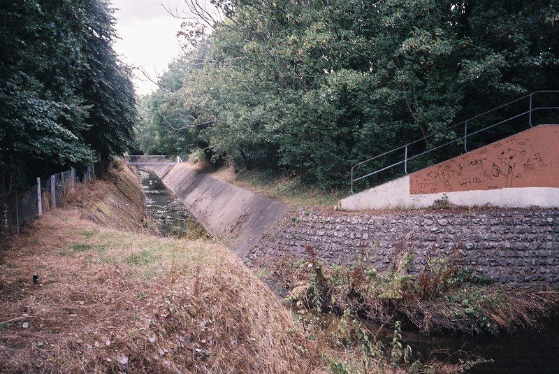
This is exactly the kind of urban river infrastructure that is getting re-wilded in various places, and while I really appreciate the photographic opportunities here, it isn’t hard to see how the concrete channel increases the likelihood of flooding, and decreases the opportunities for the stream to be a benefit for nature.
We crossed the road to a footpath, and found a place a couple of the streams merged together, then had to head back to and down the Wells Road, as there were no more footpaths.
Wells Road is (as the name suggests) the long road from the centre of Bristol to the cathedral city of Wells. It’s always busy, with lots of load traffic. I was really interested in where the Brook crossed it, as I couldn’t remember seeing it, though I’ve looked out for it, and it turns out that this is because the road goes over a viaduct that you can’t really tell is there from a car or a bus – it’s high and walled on each side. I dodged the traffic to try to see where the line of the stream was, and then had to wait to get back. The stream isn’t really visible in midsummer, but the willows give it away, and one of the themes of this walk was talking and thinking a lot about the tell-tale signs that rivers are running.

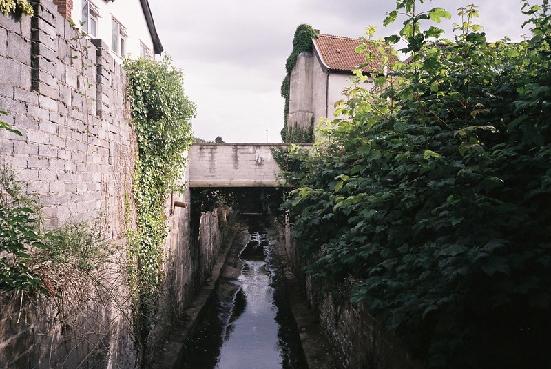
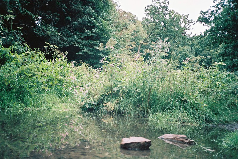
We crossed the border into Bristol, and walked down some steps to where the Brook runs in a valley, with the road high on one side, and the embankment of the former train line on the other, now the Whitchurch Railway Path. We went alongside the stream, pushing through the summer undergrowth (including brambles and thistles) and found a cracked and broken bridge. It was very overcast, too dark for great photos, which was a shame, but all the more reason to go back in winter, though I wouldn’t be able to stand in the stream bed in a normal winter…


We climbed up and followed the railway path for a while, then down some steps to cross and walk alongside Sturminster Road, where our bus had traveled earlier in the day. We turned off to follow the Brook as closely as we could, and to cross it where possible.

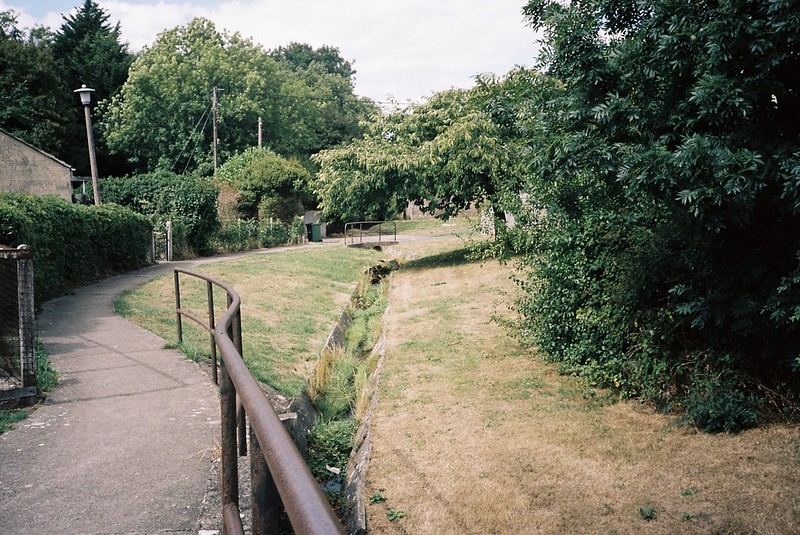
I don’t know what it’s like at other times of the year, but you can’t see the Brook unless you’re crossing it. The clues are houses only on one side of the road, and trees and bushes, with brambles in front of them.

We saw some great front gardens, and a very friendly cat which had a stand-off with a neighbouring cat, and followed the line of the footpath into the fenced path between the Knowle Golf Club on one side, and playing fields on the other, with gaps in the fence for kids to get through.

The Brook was hidden in the line of trees, the perfect corridor of nature, and next to it various rubbish, including an abandoned keyboard, and a rusted moped disintegrating into the brambles.


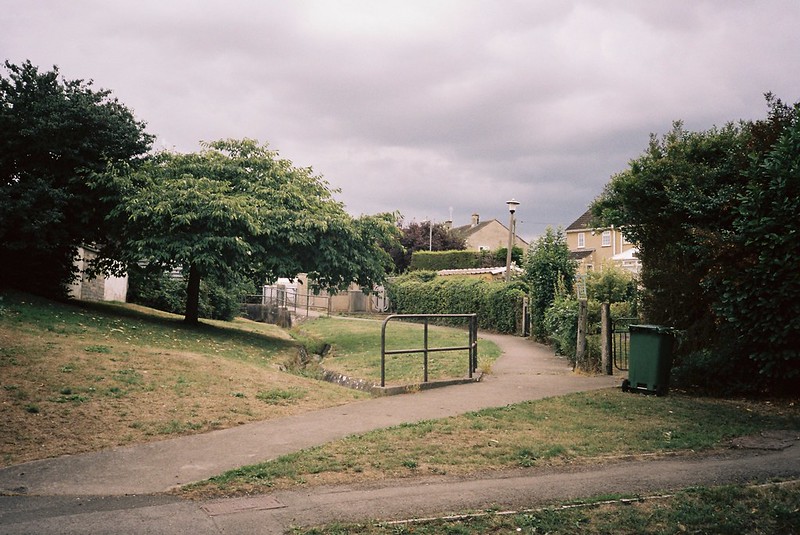
The path finishes in a street of polite semis, and the brook disappears into school grounds. We had to cross West Town Lane and skirt the edge, along an alley with barking dogs on one side. We came out along Hengrove Brook, just before it joins Brislington Brook, and Hengrove Brook is very definitely a storm drain here, to take run off from the Callington Road dual carriageway.
It deosn’t look particularly healthy here, but we walked down to see where the two rivers meet, and then headed back and through the underpass.

This next part was through 1980s estates, crossing the river occasionally, and then out into 1930s houses, taking diversions to see where the stream went

I was thinking a lot about the tell-tale signs of rivers, but the only way to tell it crosses under the Bath Road is the fact the road dips down at this point, before climbing another hill

We crossed, and took the street parallel with the brook’s path, diverting over a little footbridge, with one of my favourite examples of why I love bridges. These are the views standing on the bridge-ette, putting my camera through fences and looking south and then looking north – such different views!

We could have carried on finding more of these bridges, but we’d been walking for a while, so we diverted from the path into Brislington to go to Café Grounded for coffee, tortilla and tapas – off the route, but definitely worth it!
One of the things I really liked about the day was chatting to a local guy on our way to coffee. He’d seen me re-folding the map, and when I scampered off for photos, stopped by Tracy and Vik to see if we needed help. We told him what we were doing, and he told us all kinds of great anecdotes and factettes about Brislington and the rivers, and I loved it. We walked up the hill and through the alleys with him, and I wish I’d recorded his stories, because people who love their local history are always so fascinating.
After the coffee break, we walked down Allison Road, this long switchback, with the river valley in the middle of the dip. It was another one of those places where you have to be able to read the clues of the landscape, to know the river is there – the guess that there might be water in the valley, the lack of houses, and the gap in the trees.


Looking at these photos makes me remember the two young teachers who were running down the road to the bus stop that’s not pictured, ahead of the bus that was swooping down behind them… and straight past. The driver looked right at them as he got to the bus stop just ahead of them – the bastard! It was such a mean-spirited, pointless thing to do, and I hope he has equivalent things happen to him all year, and their commutes go well forever. I should have noted the license plate and reported him.

The next part of the walk was Nightingale Valley, where Vik and I had done a bit of exploring, back in May, on the Friends of Troopers Hill walk. At this point the sky was full of grey clouds, so it was dark in the woods (meaning my photos are either slightly blurry, or from my phone) but so lovely to be there. I really have to come back here in autumn, for the colours, in winter, for the light and the bare branches, and in spring for acid green new leaves, and maeinschein. It’s definitely a hidden gem of the city, with so many interesting things to see.


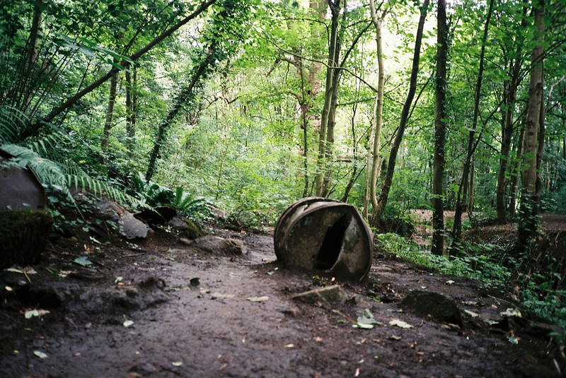
The most dramatic thing is the huge plane tree, thought to be the oldest plane in Bristol. It’s such a stunning tree, and the bricked up trunk (to stop people setting fires in it…) makes it seem even more like it’s something from a fairy tale than it already does. We crossed the weir by the tree to go and explore something else, though, that Rob Acton Campbell had told us about – the place where tar barrels were dumped on purpose or by accident, and are still left in the woods, because trying to clean them up would cause more pollution than leaving them there.

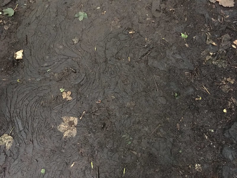
It’s a really extraordinary space, with the ground covered in tar, that was soft and giving under our feet after the heatwave, and looking like part of it had re-melted in the earlier sun. I definitely need to take some more of these in winter, and any time the trees aren’t in full leaf, because it’s extraordinary and indescribable.
Here’s what the weir by the plane tree sounded and looked like:


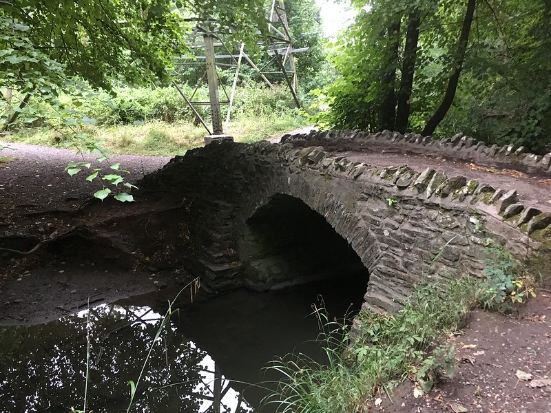
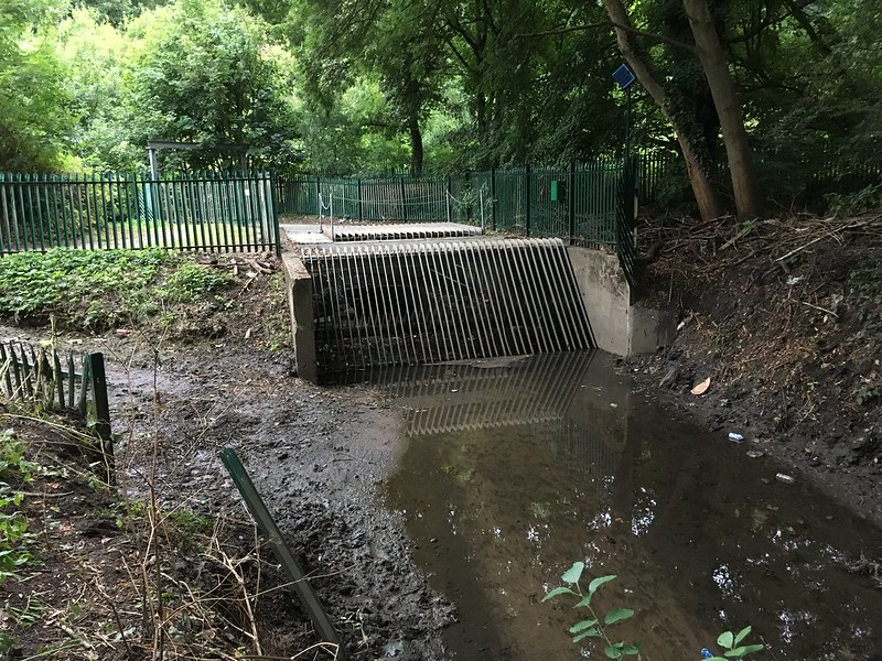
Other things we saw as we walked through the woods – the packhorse bridge and the “boat” screen for the storm water interceptor. I know I’ve been seeing it all summer, but it was still shocking seeing how low the brook level was – there were signs of the usual depth it gets to everywhere.
The path turns, and passes a house with a teepee in the front garden, and an enclosure full of ducks in the back, and then a lane that rises up to the road that crosses the railway line to London. The brook runs under the line somewhere in this picture!

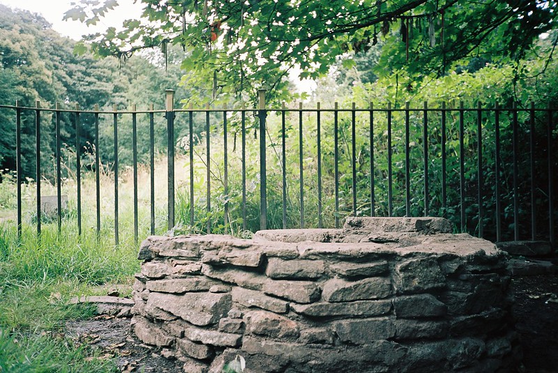
Then we crossed some roads, and went down the steps into St Anne’s Woods. By this time we were tired, and it was getting darker, so we didn’t linger, though we still stopped at the stepping stones over the Brook, and of course, St Anne’s Well.
We finished the walk at the Avon, looking at where Brislington Brook joins it. I do love a whole-river walk – it felt like an achievement, even though I’d mis-timed it, so we had to yomp down the Feeder Road rather than wait 25 mins for the next bus! But it was a good walk, with that perfect combination of places I’ve never seen before, and re-visiting others. I think of that walk and remember the conversations, the feelings, all the things I can’t record. I’m glad I did it.

If you want to know more about Brislington Brook, please do visit the Friends of Brislington Brook website, and check out the walking trails and activity sheets made by the Discover Brislington Brook project.
