This summer, I experienced something that was legitimately one of the very best things I’ve done in Bristol, and something I’ve longed to do for years – I went on the Bristol Ferry trip down the New Cut, to Netham Weir.
This is a rare trip anyway, as the Bristol Ferry Boat Company only run a couple of these a year, but for the last year they haven’t run them at all, as Ashton Avenue Bridge was covered in scaffolding for the Metrobus works. In the past I’ve only seen these trips after they happened, but for the 6th July expedition, I booked my tickets early, and persuaded some friends to come too – my good friend Matt Gibson, Charlie Revelle-Smith of Weird Bristol fame, and landscape architect Wendy Tippett, who I podcasted with last year about the Sylvia Crowe landscapes of the Cumberland Basin, and her architect husband Andrew.
Here’s the map of our trip:
and my album of photos – click through, or mouse/swipe over the first photo below, and hopefully you’ll see a slideshow. I took a lot of photos, so I’ve written about them as well below…
If you want to know about the New Cut, before I start, check out my podcast interview with Roy Gallop of the Friends of the Avon New Cut, who told me about the history of this very special part of the Avon.
It was a hot day, and Charlie and I had dumb luck, because I rocked up later than I should have, and it looked like all the outdoor seats were taken, except just as we boarded, some people headed in for the shade, and we got perfect seats at the front of the ferry. My top tip is always get there early to get to the front of the queue, and it’s just blind luck that I wasn’t stuck inside!
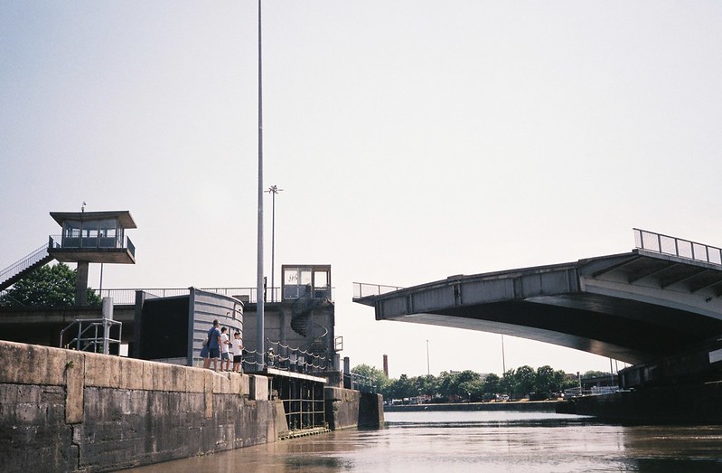
The trips start from the SS Great Britain jetty, and the first excitement is getting through the Entrance Lock, which takes much longer than you think, and is all about ramping up the anticipation, as the water drops almost invisibly, until that magical moment the lock gates open, and you’re out on the Avon – such a thrill!

The first part of the trip was north up the Avon, under the suspension bridge and through the Avon Gorge. It’s always a lovely trip, passing so many landmarks, including the Goat Gully and various nature reserves, the silt bank sculpture, the entrance to the former harbour at the bottom of the stream through Paradise Bottom, which Matt and I had walked in May, and Sea Mills, which has been in different walks I’ve been on – but I have to admit, I was chomping at the bit for us to turn round and start down the Cut. I was like some little kid waiting for her birthday, or the start of the school holidays, and I think I was practically hopping up and down when we turned back just before Horseshoe Bend, and went back the way we came, before turning into the Cut.

The New Cut is the artificial channel, dug out in the 19th Century so that the Avon’s natural course could be dammed to form the Floating Harbour, and allow boats in the port to stay at one level, rather than dealing with the second highest tidal drop in the world. While the Harbour meanders through the City, the Cut starts as a long, wide, straight line. The Friends of the Avon New Cut have had it designated as a nature reserve, as it’s an important wildlife corridor, but the part of the trip along here was bittersweet for me, as the Chocolate Path, the fantastic car-free path alongside the Cut that’s part of the National Cycle Network, has been closed for months after years of neglect.

I love this path, and it’s been so important to my Bristol life, as a place I’ve walked thousands of times, commuting, for fun, for my physical and mental health, and to get me around the city. My Photography degree show included films from the path, and I miss it every week, but it was still giving me chills to see it from this different angle. I especially liked see the outflow from the Underfall Yard into the Avon from this angle, and the underside of all the bridges, especially Vauxhall Bridge, the site of one of my photography rituals.

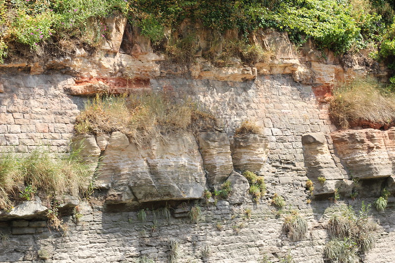
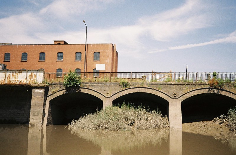
After we passed under Vauxhall Bridge, the sides of the Cut got higher, through the parts that were blasted out of rock. There are really fascinating combinations of rock formations and brickwork here, with landslides of the rocks and the walls that are slowly collapsing under the pressure of all the water that flows here.

I swear the hairs rose on the back of my neck as we passed under Gaol Ferry Bridge, which I’m currently commuting over, but has been one of my major routes into town for most of my life in Bristol. I couldn’t believe I was actually travelling on these waters I look at and photograph and dream about all the time! It was magical.

I didn’t get a good photo of the underside of the bridge, and actually there are tons of amazing moments that I didn’t photograph at all, because I was making a real effort to experience the moment first, and take photos afterwards. Having friends there to laugh at my excitement, and be just as excited themselves made the experience so much fun – getting to point things out to each other, and share stories was wonderful, and that was part of it too. I don’t regret the photos I missed, because I wanted to breathe it and feel it, and I’m still getting the buzz of how it felt exciting, and like we were doing something illicit, when I think back on it.

We passed what was the second entrance to the Floating Harbour, at God’s Garden into Bathurst Basin, and it felt like the character of the Cut changed again, as it passed some really functional spaces, through the middle of the Bedminster Bridge roundabout.

This space was particularly inspiring, because I crossed the Avon here most days for around eight years, walking to and from work, but unlike the previous parts of the Cut, which I’ve always admired, I’ve never really looked at the section in the middle, with the gorgeous arches and so much greenery, between the flats of Redcliffe. It went onto my list of places to find out more about.

After the Redcliffe flats, the Cut widened, and after passing under the Banana Bridge, the buildings seemed to fall away on either side, as we approached Bristol Temple Meads Station. The river runs right underneath the platforms, and curves beneath them, so as you enter you can’t see where you’ll come out. Of course I knew where it would be, intellectually, but it really felt like another physical boundary.
We passed the final former entrance to the Floating Harbour, by the site of the old Royal Mail Building, and here the river definitely changes, because from here we were away from the Cut, and back onto the natural river course. We passed under the Guano Bridge, the newest Avon bridge that goes from the St Philip’s Greenway to “Arena Island”, which has been a major bone of contention in Bristol politics for the last few years – will it be the arena the city wants, or will it be given over for more luxury flats to make more money for developers?
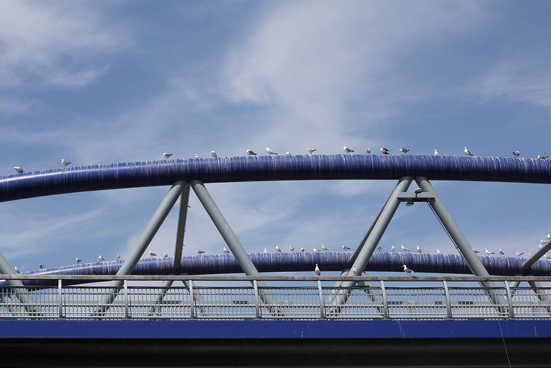
One of the best things about the Bristol Ferry trips are the great commentaries from the ferry captain, who has an endless store of anecdotes and a dry sense of humour, and he really enjoyed pointing out Arena Island, and listening to the whole boat groan. The bridge may be new, but as it’s another Bristol white elephant, its only role at the moment is providing a perch – and toilet – to all the local gulls….
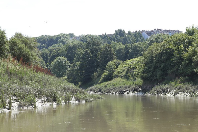
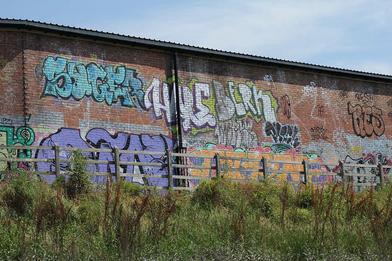
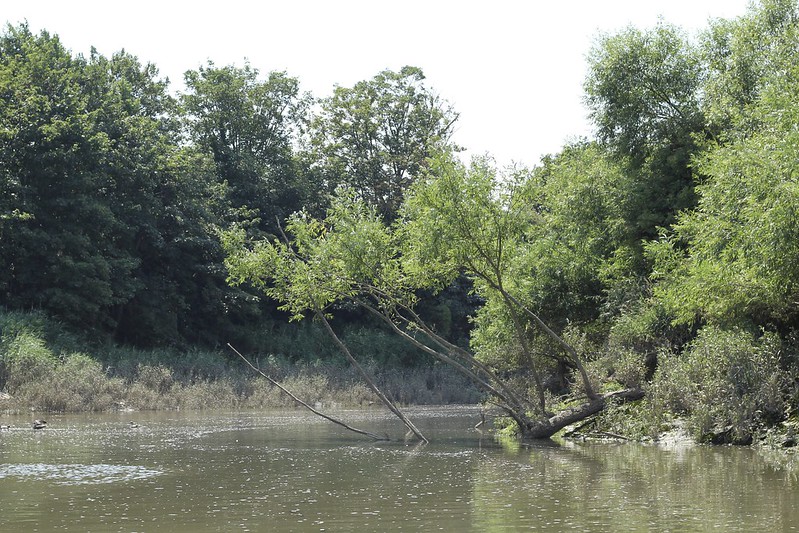
From this point the river much more curvy, and narrower, and this section has high cliffs again. Although we had the train station behind us, and a major road up on the cliffs to our right, it was so quiet, with the sound of the boat and the birds. That feeling of doing something illicit just grew here, especially as we passed workmen on the Greenway path, who were visibly surprised to see us, and called down to us. The birds were also shocked by us, and we had all these sections where we were preceded by a flock of gulls, screeching as they flew ahead of us. There was such a contrast of the bright graffiti along the Greenway, and the views ahead, which could almost be taken for rural on some of the curves.
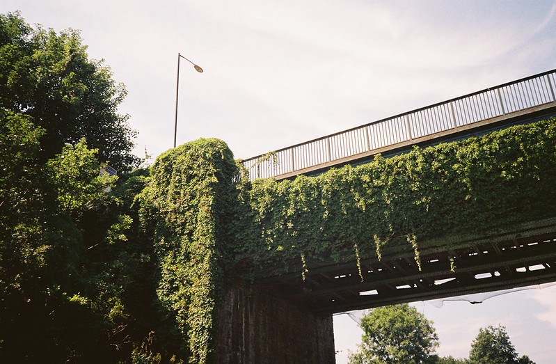
I walk the Greenway fairly regularly, but I don’t think I’ve ever noticed the Virginia Creeper growing over the Albert Bridge to the Wells Road.

I’m grinning, remembering the conversations about the Paintworks development, and how much fun it was seeing the flock of geese on the bank opposite, and seeing the dilapidation under the concrete section that I always stop at to look for fish, and to photograph Paintworks.

And then we were under the Suspension footbridge to Sparke Evans Park, and the double bridge of St Philip’s Causeway, and into the really, really thrilling section.
I don’t know what it’s officially called, but to me, it’s the closed Avon path – a section you can walk down, but with dire warnings on both ends, because the middle of the path has eroded into the river, so that at high tide it’s impassable, and there’s a real risk of getting stranded. I’ve podcasted here on an artwalk with Richard White, and on a soundwalk with Dan Pope, and I’ve walked it in the snow, and in summer, the week before the trip, but seeing it from this angle, it looked even more wild.

Somehow, the fact we could see the tops of the warehouses and industrial buildings high above the path just made it seem wilder, especially as the eroded banks and trees that fell with the landslides made the water even more narrow, like I could reach out and touch the sides. One one side, a cormorant in a tree – on the other, the five gas towers, and the commentary making it sound even more exciting. The bottom of the boat scraped something mysterious, and we were all thrilled. It felt like the nearest you can get to pushing through the undergrowth of a jungle river, in the city, and to me, that industrial contrast made it even more like something out of a science fiction book – discovering the relics of a post-apocalyptic past.

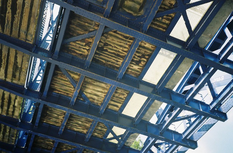
The next excitement is passing under Brunels’ Avon railway bridge, carrying the main train line to London. This is the Cinderella Bridge, and this is probably the best view of it, though being an urban decay girl at heart, I really like the collapsing “ugly sister” bridges on either side, too.

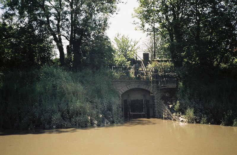
After this, we got to the eastern-most point of the journey, and the time to turn back, as we approached Netham Weir, the first place that tries to stop the Avon from being tidal. I came here for the first time last year, and it’s one of my favourite spots in the city, so of course I loved seeing it from this new angle.

We turned round and headed back the way we came, and it was just as fantastic the second time around, getting to see the same journey from the other angle. Again, the closed section was the best, despite the ominous grating of part of a tree under us in the water.

Coming back into the city was like sailing out of a book, each of those bridges we passes under like the end of a chapter.

Things that really made me smile were that “garden bridge” with the trails of Virginia Creeper, and under the Guano Bridge, seeing graffiti that I bet the writers thought was a total secret, and only they knew about

Coming out under Temple Meads again was a little bit like coming out of a dream, but there was still so much to see.

One of the special places for me was the fig tree on the south side of the river, and the place the Malago joins the Avon, which I’ve stood on top of a couple of times

The Cut widened and widened, and it was clear how much the tide had risen since we’d passed before. I didn’t want it to end, but every landmark reminded me we were getting close to the finish.
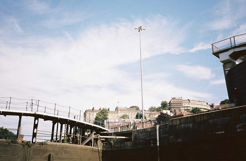
I knew it was over as we passed the Avon Viewpoint, and saw the Suspension Bridge, before turning back into the Entrance Lock, full of little leisure craft.

But the excitement wasn’t open. The same slow changes in the Lock, but as we gradually rose in the water, the Plimsoll bridge started to swing open, in that beautiful Bristolian disregard for traffic when little pleasure craft want to come into the Harbour. It always makes me smile, and it was a lovely end to a wonderful trip.
I genuinely can’t recommend that trip enough, and my absolute top tip is that you keep an eye on the Bristol Ferry Boat company’s trips page, to see when they’re running again, and BOOK IMMEDIATELY! They aren’t running any more this year, but there are still places on their standard Gorge trips, which I also recommend. I’m not exaggerating when I say that was one of the best things I’ve done in Bristol – it was mellow and exciting, inspiring and intriguing, and gave me so many more ideas of things I want to see and do in the city. Thanks so much to the Bristol Ferry captain and crew, and to Matt, Charlie, Wendy and Andrew for the company and putting up with my “happy labrador” approach. I still smile every time I think about that day, and I think I always will.

