Walking the River Trym, February 2018

My friend Tracy Homer puts up with a lot, walking with me, from clambering through ditches and up slopes, to battling knee-high brambles, walking after dark and in torrential rain, and more.  It’s a good thing she likes me, but I don’t want to push my luck, so on Wednesday’s walk with her, we walked a gentle route with no possibility of getting into scrapes – an urban nature exploration, following the River Trym from Southmead, where it first appears in Bristol, to Sea Mills, where it joins the River Avon.

The map of the walk is here:

And the photo album is here (mouse over or click on the first image and it should take you to the slideshow, or click through to flickr)

Looking back to the start of the River Trym, in Southmead

Continue reading “Walking the River Trym, February 2018”

Portishead railway and the footpath to Clevedon

I try not to repeat walks too frequently, but I really loved exploring the disused railway line in Portishead, and it’s ideally a winter walk, as it would be tons harder when covered in undergrowth, and with the plans to reopen the line, I wanted to do it again, while I still can.  So Vik and I went back last Saturday to see the line, and then walk down the footpath along the Bristol Channel to Clevedon.

The map of our walk is here:

and I have an album of photos on flickr, and below.  If you mouse over or click on the first image, it should bring up a slideshow, or use this link.

Portishead lighthouse

Continue reading “Portishead railway and the footpath to Clevedon”

A February walk: “The source of the Malago”, Stanton Drew and Maes Knoll

I’ve been walking a lot, recently, making the most of some free time, and trying to get outdoors as much as possible.  last week, my good friend Tracy Homer and I had a long day out in the hills south of Bristol, starting off looking for the source of Pigeonhouse Stream (aka the source of the Malago, but more on that later) and then getting deep into the history of the area, walking through the hills to the megalithic stone circles at Stanton Drew, and back up to Bristol via Maes Knoll, the Iron Age hill fort on the edge of the city.

Photos from the walk are here – I managed to break two cameras, with my Canon 550D just stopping working, and stupidly dropping my Olympus XA2 35mm, so they end up being just from my mobile, and my friend Cee‘s Olympus OM10….  If you mouse over or click the first photo, you should bring up the slideshow – otherwise the flickr album is here.

The source of Pigeonhouse Stream

Here’s the map of our walk:

Continue reading “A February walk: “The source of the Malago”, Stanton Drew and Maes Knoll”

Trying to walk Colliter’s Brook

This week I wanted to walk Colliter’s Brook, one of the little streams that lead into the Avon.  I haven’t walked it for ages, because the public footpath has been closed off for the (endless) Metrobus works, as the route runs alongside the brook.   But the Metrobus works are finished, so I was hoping it would be opened, because it only crosses in a couple of places – and if they’re not, surely the bus lane can be closed off, like it is around Ashton Avenue Bridge?   I was really excited to get back to the river, because I loved that walk, and I wanted to get all the way up to the Dundry Hills.  So we crossed Winterstoke Road and walked down the path to the railway crossing and the start of the footpath.

Trying to find Colliter's Brook

Continue reading “Trying to walk Colliter’s Brook”

Walking the rails, Portishead to Pill

Back in July, I went to Portishead for the first time, where Dave Chillistone of the Portishead Railway Group took me on a podcast-walk around the town and told me about the history of the Portishead to Bristol railway line, and why it should be re-opened.  One of the things Dave told me about was walking the line to Pill, and I promised myself I’d come back and walk it myself, before the railway was re-opened.   It needs to be walked in the winter, when the summer plants had died back, and Monday turned out to be the perfect day to do it – sunny, cold and dry.

My photos are here (Olympus XA2 35mm point & shoot, Canon 550D DLSR and a couple of iPhone).  If you mouse over or click on the first picture, it should take you to the slideshow, or you can go directly to the flickr album.  And there are words and a map below too.

Gate across the tracks

Continue reading “Walking the rails, Portishead to Pill”

Pigeonhouse Stream, Crox Bottom

Crox Bottom is a little park, off Hartcliffe Way, where Pigeonhouse Stream (I really love the names!) runs from the lake at the old Imperial Tobacco Factory, down to meet and run under Hartcliffe Way, and then join up with the Malago.   It’s a much bigger river than the Malago, and I don’t quite understand why it’s a tributary – but like the Malago, it’s taken underground by the Dreadnought Interceptor, a huge storm drain, so what passes out of the park is much smaller than what goes in.

I walked it with my friend Cee and her baby, on a cold-but-sunny Monday.   We’d both passed it in cars for years, and wanted to know more about it, so we parked at Imperial Park, walked down the bank along Hartcliffe Way (stopping to run across the road to see where the river comes out), and then back up along the river.  My photos are below – mouse over or click on the first one and it should pull up the slideshow – or just head to the flickr album.

Pigeonhouse Stream, Crox Bottom

Continue reading “Pigeonhouse Stream, Crox Bottom”

Avon Stories Podcast #16: Exploring the New Cut, and finding out about its Friends

Back in August, Roy Gallop, one of the founders of the Friends of the Avon New Cut, took me for a walk along the Cut, down the Chocolate Path and back along Coronation Road, and told me all about this man-made river route – the huge trench that takes the tidal river Avon through the city of Bristol.

The Cut was built to enable the river route to be turned into the fixed-height Floating Harbour, to try to keep Bristol as one of the most important ports in the UK.  Now, the Cut is an urban nature reserve, a green corridor that’s home to a wide range of flora and fauna, and the Friends of the Avon New Cut (FRANC) have worked to celebrate and protect it.

Map used with kind permission of the Friends of the Avon New Cut

But this is a sad podcast for me too, because it reminds me what we’ve lost.  Roy and I spoke about how the Cut has been neglected, and left to gradually collapse, and since we took our walk, the whole of the Chocolate Path has been closed for the foreseeable future, due to erosion.  It’s so depressing that this fantastic car-free route has been lost to the city, but I’m very glad we recorded this while we could.

Please do check out the FRANC website, and join them on their walks and talks, events and litter picking days.  You can also buy the book about the Cut that Roy published and download their walking guides.  And of course, follow them on facebook.

You can also explore the New Cut throughout history, with maps of Bristol before and after it was built, and photos and drawings and much more, on the Know Your Place website.  You can find out more about KYP in this podcast and post.

Here’s the route of our walk – and I’ll add photos to this post tomorrow, too.

***

You can download this podcast directly from the Avon Stories Soundcloud, and sign up for all the future podcasts via the Avon Stories RSS and subscribe on iTunes or Soundcloud to make sure you hear all the future stories.  You can also follow the project on twitter and instagram, for regular photos of the rivers and water in Bristol.

Avon Stories podcast #15: The unloved landscapes of Sylvia Crowe, with Wendy Tippett

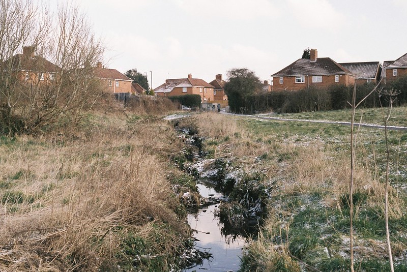
The Cumberland Basin to Ashton Gate road system is this complicated tangle of roads passing above and below each other, with endlessly confusing ways over and through it for cars and pedestrians alike.  It’s generally seen as a brutalist concrete nightmare, but back in the 1960s, when it was built, it was seen utopian and futuristic, full of exciting new ways to live in a city, with vibrant spaces and an urban park.  These included a market place and piazza on the Northern edge, a service station, a new hill, playgrounds under the roads, and of course, the viewpoint up the River Avon to the Clifton Suspension Bridge, all designed by Sylvia Crowe.

Despite having no formal schooling after leaving school at the age of ten due to TB, Crowe was an important British twentieth century landscape architect, working on everything from vast Forestry Commission schemes, New Towns, power stations and reservoirs, down to private gardens.

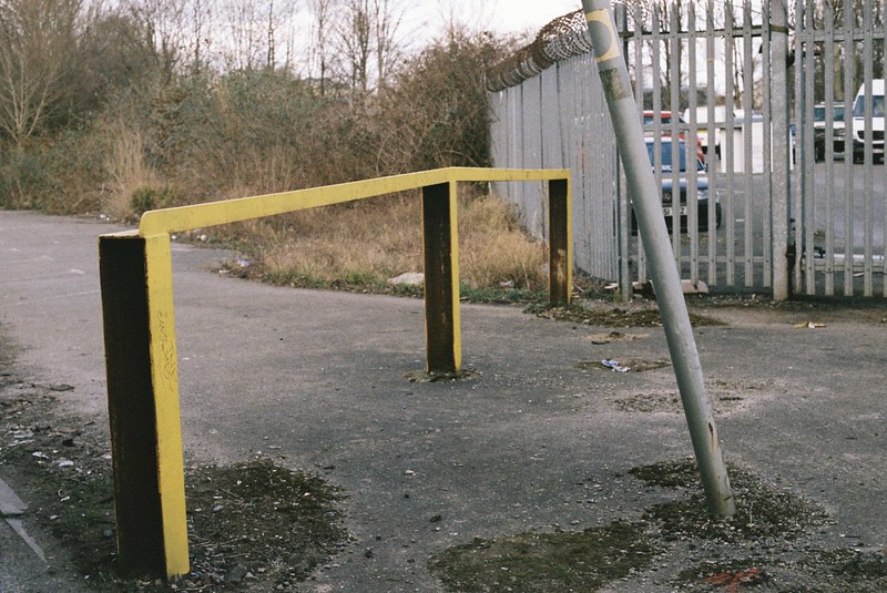
These Bristol spaces must have been incredible to see at the time, with a giant fountain spraying up between the raised lanes of traffic, and a nautical-themed playground overlooking the Entrance Lock.  The problem was that no one had predicted how fast car ownership would increase, turning what were vibrant spaces into discarded concrete no-man’s-lands.

Sylvia Crowe Cumberland Basin Bridges, Landscape Plan. Coloured up by Wendy Tippett, with our Avon Stories walk marked up in red line. Ref. Landscape Report, Cumberland Basin Bridges & Ashton Gate Junction, April 1964, University of Bristol Library

Sylvia Crowe Cumberland Basin Bridges, Landscape Plan.
Coloured up by Wendy Tippett, with our Avon Stories walk marked up in red line.
Ref. Landscape Report, Cumberland Basin Bridges & Ashton Gate Junction, April 1964, University of Bristol Library.

Landscape Architect Wendy Tippett took me walking through the northern parts of the road scheme, and told me about how the spaces would have looked in the 1960s, including the design elements that are taken for granted these days, and why, ultimately, it failed.

You can join us on the podcast we recorded on the walk, with photos and lots of links to old photos and plans below.

Sylvia Crowe Cumberland Basin Bridges & Ashton Gate Junction, Aerial View.
Ref. Tippett, W., Unloved Landscapes Dissertation, 2014.

Wendy Tippett is the Landscape Director at Andrew Kenyon Architects in Bristol and Conservation Trustee of Avon Gardens Trust, and you can follow her on her twitter.   I highly recommend her guided walks, they made me see familiar spaces with new eyes – if you’d like to arrange one for a group, or talk to her about Sylvia Crowe’s work in Bristol, you can contact her on wendy [at] andrewkenyonarchitects [dot] co [dot] uk.

If you’d like to know more about Sylvia Crowe, there’s a brief biography on the Landscape Institute website, and there’s a description of the Cumberland Basin site on Parks and Gardens.

Since we recorded this podcast, Bristol 24/7 has reported that there are plans to sell off and re-develop a lot of the site, so this is likely to change again in the future.

I retraced the walk Wendy took me on in December, and my photos (DSLR, 35mm and 120 film) are in this flickr album – click on the first photo and a slideshow should start.

Continue reading “Avon Stories podcast #15: The unloved landscapes of Sylvia Crowe, with Wendy Tippett”

A November walk through Nature Reserves

Last week, Vik and I took a November walk, starting at Sea Mills, down through the nature reserves, then along the Portway to the Goat Gully, and up around the Downs to Clifton.  We started a bit late for this time of year, getting on a bus at around 1pm, so by the time we’d got to the Suspension Bridge, it was definitely dusk.

I’ve been to these places before, but never as one walk, and that always shows new sides to places.   The Avon always looks different every time, of course, and I’ve only been the the nature reserves in the Spring before.

Photos are in this flickr set – there are photos from my DLSR, point’n’shoot 35mm and medium format film cameras.  Click through to see more, and I have more links below too.

The Avon from the Goat Gully

Continue reading “A November walk through Nature Reserves”