The Avon Valley walk around rivers of east Bristol

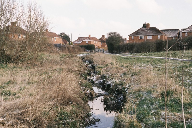
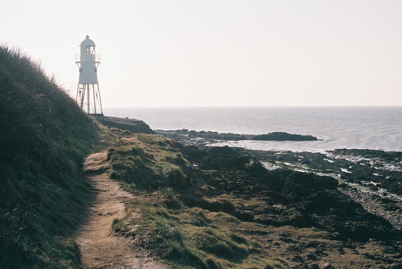
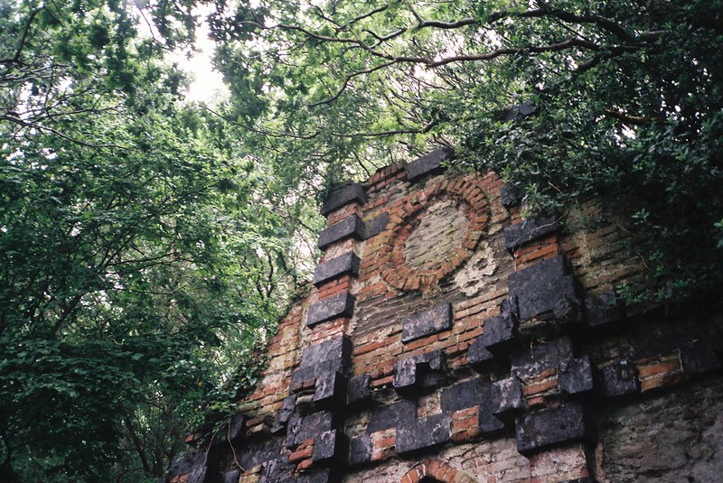
I really enjoyed the Bristol Walk Fest, and the last walk we went on was completely fantastic, one I’ve seen in the past, and wanted to do:  the Avon Valley Walk, run by Susan and Rob Acton-Campbell of the Friends of Troopers Hill.  It sold out very fast, but Vik and I put our names down on the waiting list, and were lucky enough to get places.  I have to admit, that when we were on the bus on the way over, and a massive torrential thunder storm started, we were a bit worried, but it was a fantastic day, taking in a secret bath-house, an incredible tree, water meadows, riverside lunch, a ferry, and so much more.  If you ever get the chance to go on a walk run by the Friends, do it!

I’ve tried to map the walk – apologies to Rob and Susan if I got it wrong!

And I have an album of my photos over on twitter (hopefully if you mouse over/click on the first picture, it should start the slideshow too…)


Bath house in the woods

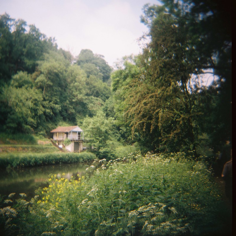
And Vik has a couple of her holga photos from the day, which I love, over on her flickr album:


The green, green grass of home....

So what did we do?

Continue reading “The Avon Valley walk around rivers of east Bristol”

Dru Marland’s latest maps

Back in February I went down to the Kennet and Avon Canal, to podcast-interview Dru Marland about living on the water, her life as an artist and poet, and a lot more.

Since then, Dru has made more gorgeous maps celebrating the water and the area, and they, like her other illustrations and poetry books, can be bought from her Etsy site.  But look how lovely they are!  Big thanks to Dru for letting me put them here.

First, her new Kennet & Avon Canal Map – the Summit and East End (this is a companion map to her previous K&A West End map)

Continue reading “Dru Marland’s latest maps”

Leigh Woods and the Avon silt banks

Back at the start of May, I had a morning trip to Leigh Woods, and it was wonderful – a perfect Spring day, with the clouds whipped across the sky, the light changing continually, from sunny to cloudy and back again.  It was such a perfect Spring day, and I loved exploring the Stokeleigh Camp Iron Age Fort, so on the way back down Nightingale Valley, I turned north and walked up the silt banks, through the long grass, and along the tide lines.   I have photos, and sounds, below, but let’s start with photos.   The album is on flickr, but if you mouse over the first picture, it should bring up a slideshow…

Stokeleigh Camp Iron Age fort

and here’s the map of where I walked – without all the back-and-forth of looking at the same things over and over!

Continue reading “Leigh Woods and the Avon silt banks”

April Avon Nature Reserves walk

Last Thursday was the hottest day of 2018 so far, a truly beautiful day, where it felt like summer, not spring, and a perfect day for a walk.  Tracy Homer and I were exploring some of the nature reserves along the Avon – a very similar walk to one I took in November last year with Vik, but in reverse.   It includes four very different nature reserves:  the Goat Gully; White’s Paddock & Bennett’s Patch (aka the home of the wicker whales); Bishop’s Knoll Woods; and Old Sneed Park Nature Reserve.

My map is here:

and there’s a photo album on flickr, or if you mouse over or click on the first photo below, it should open up the slideshow.


Ventilation shaft

So what did we do?

Continue reading “April Avon Nature Reserves walk”

Where are the rivers and streams in Bristol?

Yesterday I wanted to find out more about the Cranbrook, a little stream that’s only above ground for a couple of hundred metres in Redland, before I blogged about exploring it.  I couldn’t find out much about it, though in a comment on flickr, iyers told me it once flooded the Arches area of Gloucester Road.

But in failing to find the information I wanted, I found something better:  The Big Blue Map of Bristol from Bristol City Council, with the waters marked above and below ground as rivers (though I assume they aren’t showing the ones, like the Cranbrook, might join the sewer system. I love this map, it’s so useful!  You know I’m going to be pouring over this, with my OS maps next to me, and planning more walks…

Snowy walk along the closed Avon path

Last Saturday the snow was still around, and I went walking in it with my friends Kate and Tim.  They’d never been down the closed part of the Avon footpath, or seen the Netham Weir, which is there to try to stop the Avon being tidal, so off we went.

Map of our walk:

And photos too.   If you mouse over/click on the first photo it should open the slideshow, or you can go directly to the flickr album.


BOC Gas

Continue reading “Snowy walk along the closed Avon path”

Walking the River Trym, February 2018

My friend Tracy Homer puts up with a lot, walking with me, from clambering through ditches and up slopes, to battling knee-high brambles, walking after dark and in torrential rain, and more.  It’s a good thing she likes me, but I don’t want to push my luck, so on Wednesday’s walk with her, we walked a gentle route with no possibility of getting into scrapes – an urban nature exploration, following the River Trym from Southmead, where it first appears in Bristol, to Sea Mills, where it joins the River Avon.

The map of the walk is here:

And the photo album is here (mouse over or click on the first image and it should take you to the slideshow, or click through to flickr)

Looking back to the start of the River Trym, in Southmead

Continue reading “Walking the River Trym, February 2018”

Portishead railway and the footpath to Clevedon

I try not to repeat walks too frequently, but I really loved exploring the disused railway line in Portishead, and it’s ideally a winter walk, as it would be tons harder when covered in undergrowth, and with the plans to reopen the line, I wanted to do it again, while I still can.  So Vik and I went back last Saturday to see the line, and then walk down the footpath along the Bristol Channel to Clevedon.

The map of our walk is here:

and I have an album of photos on flickr, and below.  If you mouse over or click on the first image, it should bring up a slideshow, or use this link.

Portishead lighthouse

Continue reading “Portishead railway and the footpath to Clevedon”

A February walk: “The source of the Malago”, Stanton Drew and Maes Knoll

I’ve been walking a lot, recently, making the most of some free time, and trying to get outdoors as much as possible.  last week, my good friend Tracy Homer and I had a long day out in the hills south of Bristol, starting off looking for the source of Pigeonhouse Stream (aka the source of the Malago, but more on that later) and then getting deep into the history of the area, walking through the hills to the megalithic stone circles at Stanton Drew, and back up to Bristol via Maes Knoll, the Iron Age hill fort on the edge of the city.

Photos from the walk are here – I managed to break two cameras, with my Canon 550D just stopping working, and stupidly dropping my Olympus XA2 35mm, so they end up being just from my mobile, and my friend Cee‘s Olympus OM10….  If you mouse over or click the first photo, you should bring up the slideshow – otherwise the flickr album is here.

The source of Pigeonhouse Stream

Here’s the map of our walk:

Continue reading “A February walk: “The source of the Malago”, Stanton Drew and Maes Knoll”